Back Landkreis Donau-Ries ALS Districto de Danubio-Ries AN Landkroas Donau-Rias BAR Zemský okres Dunaj-Ries Czech Landkreis Donau-Ries Danish Landkreis Donau-Ries German Donau-Ries English Distrikto Donau-Ries Esperanto Distrito de Danubio-Ries Spanish دناو-ریس Persian
| Landkreis Donau-Ries | ||
| Donauwörth | ||
| Distrito | ||
|
||
| Nasod | ||
|---|---|---|
| Estado pederal | Bavaria | |
| Distrito nga gobyerno | Swabia | |
| Gitas-on | 508 m (1,667 ft) | |
| Tiganos | 48°48′58″N 10°43′19″E / 48.81611°N 10.72194°E | |
| Area | 1,275.00 km2 (492 sq mi) | |
| Population | 128,939 (2014-01-03) [1] | |
| Density | 101 / km2 (262 / sq mi) | |
| Timezone | CET (UTC+1) | |
| - summer (DST) | CEST (UTC+2) | |
| GeoNames | 2936260 | |
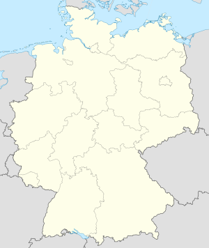
Ang Landkreis Donau-Ries usa ka distrito sa Alemanya.[1] Ang Landkreis Donau-Ries nahimutang sa distrito nga gobyerno sa Swabia ug sa estado pederal sa Bavaria, sa habagatang bahin sa nasod, 500 ka km sa habagatan gikan sa ulohang dakbayang Berlin. Adunay 128,939 ka molupyo.[1] Ang dapit sa Landkreis Donau-Ries 1,275 ka mga kilometrong kwadrado. Ang Landkreis Donau-Ries mopakigbahin sa usa ka utlanan sa Landkreis Ansbach, Landkreis Weißenburg-Gunzenhausen, Landkreis Eichstätt, Landkreis Neuburg-Schrobenhausen, Landkreis Aichach-Friedberg, Landkreis Augsburg, Landkreis Dillingen an der Donau, Landkreis Heidenheim, ug Ostalbkreis.
Ang yuta sa Landkreis Donau-Ries patag sa habagatang-kasadpan, apan sa amihang-sidlakan kini mao ang kabungtoran.[saysay 1]
Ang Landkreis Donau-Ries gibahinbahin sa mosunod nga mga subdibisyon:
- Esterholz
- Dornstadt-Linkersbaindt
- Brand
- Wallerstein
- Kaisheim
- Wemding
- Rain
- Oettingen in Bayern
- Nördlingen
- Monheim
- Harburg
- Donauwörth
- Forheim
- Ehingen am Ries
- Ederheim
- Deiningen
- Daiting
- Buchdorf
- Auhausen
- Asbach-Bäumenheim
- Amerdingen
- Alerheim
- Marxheim
- Marktoffingen
- Maihingen
- Huisheim
- Holzheim
- Hohenaltheim
- Hainsfarth
- Genderkingen
- Fünfstetten
- Fremdingen
- Reimlingen
- Otting
- Oberndorf a.Lech
- Niederschönenfeld
- Münster
- Munningen
- Möttingen
- Mönchsdeggingen
- Mertingen
- Megesheim
- Wolferstadt
- Wechingen
- Tapfheim
- Tagmersheim
- Rögling
Ang mga tanom sa palibot sa Landkreis Donau-Ries hapit tanan kaumahan.[3] Ang dapit palibot sa Landkreis Donau-Ries medyo hilabihan populasyon, uban sa 104 ka mga tawo sa tinagsang kilometro kwadrado.[4] Ang klima baybayon.[5] Ang kasarangang giiniton 8 °C. Ang kinainitan nga bulan ang Hulyo, sa 20 °C, ug ang kinabugnawan ang Disyembre, sa −4 °C.[6] Ang kasarangang pag-ulan 999 ka milimetro matag tuig. Ang kinabasaan nga bulan ang Agosto, sa 126 ka milimetro nga ulan, ug ang kinaugahan ang Marso, sa 30 milimetro.[7]
| ||||||||||||||||||||||||||||||||||||||||||||||||||||||||||||||||||||||||||||||||||||||||||||||||||||||||||||||||||||||||||||
- ↑ 1.0 1.1 1.2 Cite error: Invalid
<ref>tag; no text was provided for refs namedgn2936260 - ↑ Cite error: Invalid
<ref>tag; no text was provided for refs namedvp - ↑ Cite error: Invalid
<ref>tag; no text was provided for refs namednasalandcover - ↑ Cite error: Invalid
<ref>tag; no text was provided for refs namednasapop - ↑ Cite error: Invalid
<ref>tag; no text was provided for refs namedkoppen - ↑ 6.0 6.1 Cite error: Invalid
<ref>tag; no text was provided for refs namednasa - ↑ Cite error: Invalid
<ref>tag; no text was provided for refs namednasarain
Cite error: <ref> tags exist for a group named "saysay", but no corresponding <references group="saysay"/> tag was found


