| Topographers Range | |
| Kabukiran | |
| Nasod | |
|---|---|
| Lalawigan | Northern Province |
| Gitas-on | 914 m (2,999 ft) |
| Tiganos | 9°10′44″S 149°05′03″E / 9.17899°S 149.08423°E |
| Highest point | |
| - location | Mount Victory |
| - elevation | 1,884 m (6,181 ft) |
| - coordinates | 9°12′36″S 149°04′24″E / 9.20999°S 149.07333°E |
| Kadugayon | 10 km (6 mi), amihanan-habagatan |
| Timezone | AEST (UTC+10) |
| GeoNames | 2085206 |
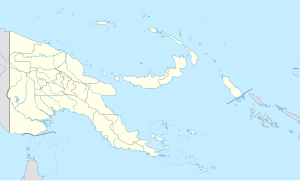
Kabukiran ang Topographers Range sa Nugini sa Papua.[1] Nahimutang ni sa lalawigan sa Northern Province, sa habagatan-sidlakang bahin sa nasod, 210 km sa sidlakan sa Port Moresby ang ulohan sa nasod.
Topographers Range mihatag alang sa 9.8 km sa usa ka amihanan-habagatan nga direksyon.[saysay 1] Ang labing taas nga punto mao ang Mount Victory, 1,884 metros ibabaw sa dagat nga lebel.
Ang mosunod nga mga bukid sa mga bahin sa Topographers Range:
- ↑ Cite error: Invalid
<ref>tag; no text was provided for refs namedgn2085206 - ↑ Cite error: Invalid
<ref>tag; no text was provided for refs namedvp
Cite error: <ref> tags exist for a group named "saysay", but no corresponding <references group="saysay"/> tag was found

