Back نوينكيرشن أم براند Arabic نوينكيرشن ام براند ARZ Neunkirchen am Brand BAR Нойнкирхен-ам-Бранд CE Neunkirchen a.Brand CEB Neunkirchen am Brand German Neunkirchen am Brand English Neunkirchen am Brand Esperanto Neunkirchen am Brand Spanish Neunkirchen am Brand Basque
| Neunkirchen a.Brand | |
 | |
| Våben | Beliggenhed |
 |
|
| Administration | |
| Land | |
|---|---|
| Delstat | Bayern |
| Admin. region | Oberfranken |
| Kreis | Forchheim |
| Borgmester | Heinz Richter (FWG) |
| Statistiske data | |
| Areal | 26,37 km² |
| Højde | 317 m |
| Indbyggere | 8.104 (31/12/2018) |
| - Tæthed | 307 Indb./km² |
| Andre informationer | |
| Tidszone | CET/CEST (UTC+1/UTC+2) |
| Nummerplade | FO |
| Postnr. | 91077 |
| Tlf.-forvalg | 09134 |
| Koordinater | 49°37′N 11°8′Ø / 49.617°N 11.133°Ø |
| Hjemmeside | www.neunkirchen-am-brand.de |
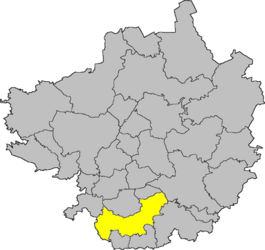
| Beliggenhed af købstaden Neunkirchen a.Brand i Landkreis Forchheim | |
 | |
Neunkirchen am Brand (eller Neunkirchen a.Brand) er en købstad (markt) i Landkreis Forchheim i Regierungsbezirk Oberfranken i den tyske delstat Bayern.
