Back Индиа Abkhazian India ACE Индие ADY Indië Afrikaans Indien ALS ህንድ Amharic India AMI India AN Indea ANG India ANN
India
| Pahi la | South Asia, Commonwealth of Nations, South Asian Association for Regional Cooperation, Non-Aligned Movement |
|---|---|
| Di pilli ni | 15 Silimin gɔli August 1947 |
| Yu'maŋli | भारत गणराज्य, Republic of India |
| Balli | Indo-Aryan peoples, Dravidian peoples |
| Participant in | BASIC countries, G4 nations, Group of Five |
| Siɣili-lana yuli | Indus River |
| Yɛltɔɣa din nyɛ tuma ni dini | Hindi, Silmiinsili |
| Tiŋgbani silima | Jana Gana Mana |
| Kali | culture of India |
| Taachi | Satyameva Jayate |
| Taachi sabbu | सत्यमेव जयते |
| Dunia yaɣili | Asia |
| Tiŋa | India |
| Tinzuɣu | New Delhi |
| Wakati luɣili | Indian Standard Time, Asia/Kolkata |
| Be ni bee n pa kodoosheei zuɣu | Arabian Sea, Bay of Bengal, Indian Ocean |
| Tiŋgbaŋ yaɣili calinli | 22°48′0″N 83°0′0″E |
| Coordinates of easternmost point | 28°0′42″N 97°23′44″E |
| Coordinates of northernmost point | 35°40′28″N 76°50′40″E |
| Coordinates of southernmost point | 6°44′48″N 93°50′33″E |
| Coordinates of westernmost point | 23°37′34″N 68°11′39″E |
| Highest point | Kanchenjunga |
| Lowest point | Kuttanad |
| Din nyɛ gɔmnanti nyolini | federal republic, parliamentary democracy |
| Office held by head of state | President of India |
| Tiŋgban zuɣ'lana | Droupadi Murmu |
| Office held by head of government | Prime Minister of India |
| Tiŋgbani zuɣ'lana | Narendra Modi |
| Kpamba yaɣili | executive branch of the Government of India |
| Loo zalibu yaɣa | Parliament of India |
| Saliya dibu kpamba ban be tooni | Supreme Court of India |
| Central bank | Reserve Bank of India |
| Public holiday | Republic Day, International Workers' Day, Independence Day, Gandhi Jayanti |
| Tingbani liɣiri | Indian rupee |
| Duhubu yaɣili | left |
| Niɣilim buɣum polo puloku balishɛli | Europlug, AC power plugs and sockets: British and related types, BS 546 |
| Din doli na | British Raj |
| Significant event | independence of India, political integration of India, Emergency |
| Ŋun bɔhim ŋa nyɛ | Indology |
| Lahabaya dundɔŋ din mali dihitabili | http://india.gov.in/ |
| Hasitagi | India, भारत, india |
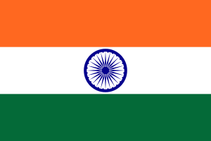
| Tuuta | flag of India |
| Coat of arms | Emblem of India |
| Official symbol | Emblem of India |
| Geography of topic | geography of India |
| Nahingbaŋ | free country |
| Taarihi bachikpani dalinli | history of India |
| Ziligi naba trafiki yaɣili | left |
| Open data portal | Open Government Data Platform India |
| Bibliography | bibliography of India |
| Economy of topic | economy of India |
| Demographics of topic | demographics of India |
| Mobile country code | 405, 404 |
| Tiŋgbani boligu zalikpana | +91 |
| Trunk prefix | 0 |
| Zuɣusaa zuɣusaa tangalimia lamba | 112, 100, 101, 102, 108 |
| GS1 tiŋgbani code | 890 |
| Lansisi plati koodi | IND |
| Maritime lamba kalinli | 419 |
| Stack Exchange tag | https://travel.stackexchange.com/tags/india |
| Unicode bachinima | 🇮🇳 |
| Di kalimi pahi | list of cities and towns in India |
| Category for maps or plans | Category:Maps of India |

India nyɛla tiŋgban' shɛli din be Southern Asia.
