Back Castleisland CEB Castleisland English Castleisland Spanish Castleisland Basque Castleisland French Oileán Ciarraí Irish Castleisland Italian Castleisland Dutch Castleisland Polish Каслайленд Russian
| Castleisland Oileán Chiarraí Castleisland | ||
|---|---|---|
|
| ||
| Koordinaten | 52° 14′ 5″ N, 9° 27′ 43″ W | |
| Basisdaten | ||
| Staat | Irland | |
| Provinz | Munster | |
| Grafschaft | Kerry | |
| ISO 3166-2 | IE-KY | |
| Höhe | 34 m | |
| Fläche | 2,1 km² | |
| Einwohner | 2536 (2022) | |
| Dichte | 1.207,6 Ew./km² | |
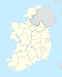
Castleisland (irisch Oileán Chiarraí) ist eine Landstadt im County Kerry im Südwesten der Republik Irland.[1]
- ↑ Karte von Irland (stark vergrößerbar) ( vom 4. Oktober 2018 im Internet Archive)
