Back چورلی AZB Chorley Catalan Chorley (kapital sa distrito) CEB Chorley Welsh Chorley Danish Chorley English Chorley Spanish Chorley Basque چورلی Persian Chorley French
| Chorley | ||
|---|---|---|
 | ||
| Staat: | ||
| Koordinaten | 53° 39′ N, 2° 38′ W | |
|
| ||
| Traditionelle Grafschaft | Lancashire | |
| Einwohner | 36.183 (Stand: 2011) | |
| Verwaltung | ||
| Post town | CHORLEY | |
| Postleitzahlenabschnitt | PR6, PR7 | |
| Landesteil | England | |
| Region | North West | |
| District | Chorley | |
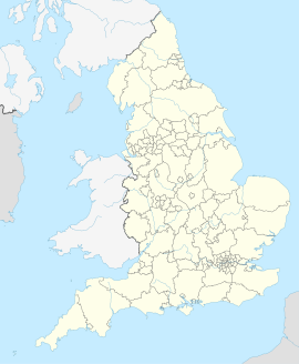
Chorley ist eine Stadt im District Chorley in der Grafschaft Lancashire, England. Chorley ist 45,5 km von Lancaster entfernt.[1] Im Jahr 2011 hatte es eine Bevölkerung von 36.183 und Borough of Chorley 107.155.[2]
Der Round Loaf ist ein Tumulus auf dem Anglezarke Moor östlich von Chorley.
- ↑ GENUKI: Distance from CHORLEY [SD582176]. Abgerufen am 26. April 2017 (englisch).
- ↑ The Editors of Encyclopædia Britannica: Chorley. Encyclopædia Britannica, abgerufen am 26. April 2017 (englisch).
