Back كوبا (البرتغال) Arabic Cuba (Portugal) Catalan Куба (Португали) CE Cuba (munisipyo) CEB Cuba, Portugal English Cuba (Portugalio) Esperanto Cuba (Portugal) Spanish Cuba (Portugal) Basque Cuba Finnish Cuba (Portugal) French
| Cuba | ||||||
|---|---|---|---|---|---|---|
| ||||||
| Basisdaten | ||||||
| Staat: | ||||||
| Region: | Alentejo | |||||
| Unterregion: | Baixo Alentejo | |||||
| Distrikt: | Beja | |||||
| Concelho: | Cuba | |||||
| Koordinaten: | 38° 10′ N, 7° 53′ W | |||||
| Einwohner: | 3092 (Stand: 19. April 2021)[1] | |||||
| Fläche: | 70,09 km² (Stand: 1. Januar 2010)[2] | |||||
| Bevölkerungsdichte: | 44 Einwohner pro km² | |||||
| Politik | ||||||
| Adresse der Gemeindeverwaltung: | Junta de Freguesia de Cuba Rua João Vaz 7940-159 Cuba | |||||
| Website: | jfcuba.no.sapo.pt | |||||
| Kreis Cuba | ||||||
| ||||||
| Einwohner: | 4373 (Stand: 19. April 2021)[3] | |||||
| Fläche: | 172,09 km² (Stand: 1. Januar 2010)[2] | |||||
| Bevölkerungsdichte: | 25 Einwohner pro km² | |||||
| Anzahl der Gemeinden: | 4 | |||||
| Verwaltung | ||||||
| Adresse der Verwaltung: | Câmara Municipal de Cuba Rua Serpa Pinto 84 7940-172 Cuba | |||||
| Präsident der Câmara Municipal: | Francisco A. G. Orelha | |||||
| Website: | www.cm-cuba.pt | |||||
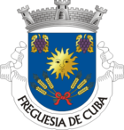
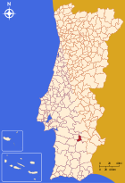
Cuba ist eine Vila (Kleinstadt) und ein Kreis (Concelho) in der Subregion des Baixo Alentejo in Portugal, mit einer Fläche von 70,1 km² und einer Bevölkerung von 3092 Einwohnern (Stand 19. April 2021). Cuba ist ein landwirtschaftliches Zentrum der Region, und einer der Orte, die Christoph Kolumbus als Sohn ihrer Stadt bezeichnen.
- ↑ www.ine.pt – Indikator Resident population by Place of residence and Sex; Decennial in der Datenbank des Instituto Nacional de Estatística
- ↑ a b Übersicht über Code-Zuordnungen von Freguesias auf epp.eurostat.ec.europa.eu
- ↑ www.ine.pt – Indikator Resident population by Place of residence and Sex; Decennial in der Datenbank des Instituto Nacional de Estatística


