Back درومونفيل Arabic Drummondville ATJ دروموندویل AZB Драмандвіль BE-X-OLD Drummondville (lungsod) CEB Drummondville, Quebec DIQ Ντράμοντβιλ Greek Drummondville English Drummondville Spanish Drummondville Estonian
| Drummondville | ||
|---|---|---|
 Bahnhof von Drummondville | ||
| Lage in Québec | ||
| Staat: | ||
| Provinz: | Québec | |
| Région administrative: | Centre-du-Québec | |
| MRC oder Äquivalent: | Drummond | |
| Koordinaten: | 45° 53′ N, 72° 30′ W | |
| Höhe: | 88 m | |
| Fläche: | 247,15 km² | |
| Einwohner: | 75.423 (Stand: 2016[1]) | |
| Bevölkerungsdichte: | 305,2 Einw./km² | |
| Zeitzone: | Eastern Time (UTC−5) | |
| Gemeindenummer: | 49058 | |
| Postleitzahl: | J2A-J2C, J2E | |
| Vorwahl: | +1 819 | |
| Bürgermeister: | Stéphanie Lacoste | |
| Website: | www.ville.drummondville.qc.ca | |
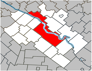
 Lage in der MRC Drummondville | ||
Drummondville () ist eine Stadt im Süden der kanadischen Provinz Québec. Sie liegt in der Verwaltungsregion Centre-du-Québec, rund 105 km nordöstlich von Montreal und 150 km südwestlich der Provinzhauptstadt Québec. Drummondville ist Verwaltungssitz von Centre-du-Québec und der regionalen Grafschaftsgemeinde (municipalité régionale du comté) Drummond, hat eine Fläche von 247,15 km² und zählt 75.423 Einwohner (Stand: 2016).
- ↑ Statistics Canada: Census Profile, 2016 Census – Drummondville, Ville (Census subdivision), Quebec and Quebec (Province), abgerufen am 30. Mai 2021
