Back هوبكينتون (رود آيلاند) Arabic هوبكينتون ARZ Hopkinton (Rhode Island) Catalan Гопкинтон CE Hopkinton (lungsod sa Tinipong Bansa, Rhode Island) CEB Hopkinton, Rhode Island Welsh Hopkinton, Rhode Island English Hopkinton (Rhode Island) Spanish Hopkinton (Rhode Island) Basque Hopkinton (Rhode Island) French
| Hopkinton | ||
|---|---|---|
|
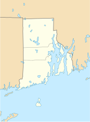
Lage in Rhode Island
| ||
| Basisdaten | ||
| Staat: | Vereinigte Staaten | |
| Bundesstaat: | Rhode Island | |
| County: | Washington County | |
| Koordinaten: | 41° 28′ N, 71° 47′ W | |
| Zeitzone: | Eastern (UTC−5/−4) | |
| Einwohner: – Metropolregion: |
8.398 (Stand: 2020) 1.072.610 (Stand: 2020) | |
| Haushalte: | 3.203 (Stand: 2020) | |
| Fläche: | 114,3 km² (ca. 44 mi²) | |
| Bevölkerungsdichte: | 73 Einwohner je km² | |
| Höhe: | 51 m | |
| Postleitzahlen: | 02804 (Ashaway), 02808 (Bradford), 02833 (Hopkinton City), 02832 (Hope Valley), 02873 (Rockville), 02898 (Wyoming)[1] | |
| Vorwahl: | +1 401 | |
| FIPS: | 44-35380 | |
| GNIS-ID: | 1220092 | |
| Website: | www.hopkintonri.gov | |
Hopkinton[2] ist eine Stadt im Washington County im US-amerikanischen Bundesstaat Rhode Island. Das U.S. Census Bureau hat bei der Volkszählung 2020 eine Einwohnerzahl von 8.398[3] ermittelt.
- ↑ US Postal Service - ZIP Codes
- ↑ Hopkinton. In: Geographic Names Information System. United States Geological Survey, United States Department of the Interior, abgerufen am 2. September 2012 (englisch).
- ↑ Explore Census Data Hopkinton town, Washington County, Rhode Island. Abgerufen am 13. Januar 2023.
