| |
|---|---|
| Karte | |

| |
| Basisdaten | |
| Gesamtlänge: | 17,20 mi/27,68 km |
| Anfangspunkt: | |
| Endpunkt: | |
| Countys: | Queen Anne’s County Kent County |
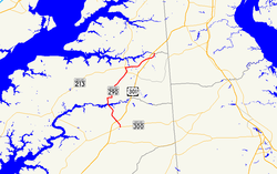
Die Maryland State Route 290 (kurz MD 290) ist eine State Route im US-Bundesstaat Maryland, die in Nord-Süd-Richtung verläuft.
Die State Route beginnt an der Maryland State Route 300 in Dudley Corners und endet nach 28 Kilometern in Sassafras an der Maryland State Route 299.
