Back جبل مونت فوريل ARZ Mont Forel CEB Mont Forel Danish Mont Forel English Mont Forel French Monte Forel Italian フォレル山 Japanese ფორელის მთა Georgian Mont Forel LLD Forela kalns Latvian/Lettish
| Mont Forel | ||
|---|---|---|
| Höhe | 3391 m | |
| Lage | Distrikt Ammassalik, Kommuneqarfik Sermersooq, Grönland | |
| Gebirge | Schweizerland | |
| Dominanz | 357 km → Styggehorn | |
| Schartenhöhe | 1596 m | |
| Koordinaten | 66° 56′ 6″ N, 36° 47′ 15″ W | |
|
| ||
| Erstbesteigung | 12. August 1938 durch André Roch, Guido Pidermann und Carl Baumann | |
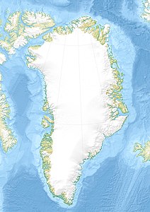
Der Mont Forel ist ein 3391 m hoher Berg im Distrikt Ammassalik in der Kommuneqarfik Sermersooq auf Grönland.
