Back Onotoa Catalan Onotoa (konseho sa pulo sa Kiribati) CEB Ονοτόα Greek Onotoa English Onotoa Spanish Onotoa Estonian اونوتوآ Persian Onotoa Finnish Onotoa Faeroese Onotoa French
| Onotoa | ||
|---|---|---|
 | ||
| Gewässer | Pazifischer Ozean | |
| Archipel | Gilbertinseln | |
| Geographische Lage | 1° 51′ S, 175° 33′ O | |
|
| ||
| Anzahl der Inseln | 6 | |
| Hauptinsel | Buariki | |
| Landfläche | 15,62 km² | |
| Lagunenfläche | 75,38 km² | |
| Höchste Erhebung | 3 m | |
| Einwohner | 1417 (2020[1]) | |
 | ||
 | ||
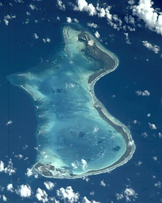
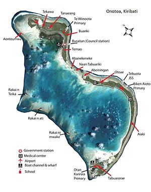
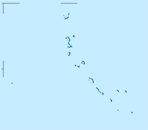
Onotoa ist ein Atoll im pazifischen Archipel der Gilbertinseln und gehört zum Staat Kiribati. Es liegt ca. 70 km nordwestlich von Tamana, der kleinsten Insel des Archipels.
- ↑ Aritita Tekaieti (Hrsg.): 2020 Population and Housing General Report and Results. Republic of Kiribati – National Statistics Office, Ministry of Finance, Juli 2021, Table G-1: History Table for Kiribati Population by island for Census year 1947 to 2020, S. 17 (englisch, Downloadlink [PDF; 48,2 MB; abgerufen am 8. März 2023]).
