Back Paraoa AST Paraoa Azerbaijani Paraoa Catalan Atoll Paraoa CEB Paraoa English Paraoa Spanish Paraoa French Atol Paraoa Galician Paraoa Italian Параоа MRJ
| Paraoa | ||
|---|---|---|
 | ||
| Gewässer | Pazifischer Ozean | |
| Archipel | Tuamotu-Archipel | |
| Geographische Lage | 19° 8′ S, 140° 41′ W | |
|
| ||
| Pflichtparameter INSELN fehlt | ||
| Landfläche | 4 km² | |
| Lagunenfläche | 14 km² | |
| Einwohner | unbewohnt | |
 | ||
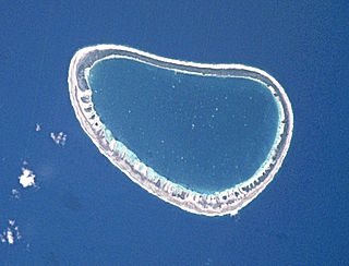
Paraoa, andere Namen: Tohora, Hariri, Gloucester Island,[1] ist eine kleine, unbewohnte Insel im Südpazifik, die geografisch zum Tuamotu-Archipel gehört.
- ↑ J. L. Young: Names of the Paumotu Islands; in: The Journal of the Polynesian Society, Volume 8 (4) vom Dezember 1899, S. 264–268 (https://www.jps.auckland.ac.nz/document.php?wid=368&action=null online)
