Back بورتو سيجورو Arabic পর্টো সেগুরো BPY Porto Seguro Breton Porto Seguro Catalan Порту-Сегуру CE Porto Seguro (munisipyo) CEB Porto Seguro Danish Porto Seguro English Porto Seguro Esperanto Porto Seguro Spanish
| Município de Porto Seguro „Terra Mãe do Brasil“ Porto Seguro
| |||
|---|---|---|---|
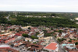
 Luftaufnahme des Stadtzentrums | |||
|
| |||
| Koordinaten | 16° 27′ S, 39° 4′ W | ||
 Lage von Porto Seguro im Bundesstaat Bahia Lage von Porto Seguro im Bundesstaat Bahia
| |||
| Symbole | |||
| |||
| Wahlspruch „Jam ante brasiliam ego“ | |||
| Gründung | 30. Juni 1534 (490 Jahre) | ||
| Basisdaten | |||
| Staat | Brasilien | ||
| Bundesstaat | Bahia | ||
| ISO 3166-2 | BR-BA | ||
| Mesoregion | Extrmo Sul Baiano | ||
| Mikroregion | Porto Seguro | ||
| Gliederung | 5 Distrikte, 35 Bairros | ||
| Höhe | 4 m | ||
| Gewässer | Atlantik | ||
| Fläche | 2.285,7 km² | ||
| Einwohner | 126.929 (2010[1]) | ||
| Dichte | 55,5 Ew./km² | ||
| Schätzung | 152.529 Ew. (zuletzt: 1. Juli 2021)[1] | ||
| Gemeindecode | IBGE: 2925303 | ||
| Postleitzahl | 45810-000 | ||
| Telefonvorwahl | (+55) 73 | ||
| Zeitzone | UTC−3 | ||
| Website | portoseguro.ba (brasilianisches Portugiesisch) | ||
| Politik | |||
| Stadtpräfektin | Jânio Natal (2020–2024) | ||
| Partei | PL | ||
| Wirtschaft | |||
| BIP | 3.379.270 Tsd. R$ 22.728 R$ pro Kopf (2019) | ||
| HDI | 0,676 (2010) | ||
Porto Seguro, amtlich Município de Porto Seguro, ist eine Küstenstadt im Süden des Bundesstaats Bahia in Brasilien am Südatlantik.
Die Stadt hatte nach Schätzung des Statistikamtes IBGE vom 1. Juli 2021 152.529 Einwohner, Porto-Segurenser genannt. Die Fläche betrug 2019 rund 2286 km².[1] Seit der Volkszählung 2010 erlebte sie einen Zuwachs von rund 25.000 Einwohnern innerhalb von 11 Jahren.
- ↑ a b c IBGE: Porto Seguro – Panorama. Abgerufen am 22. Oktober 2022 (brasilianisches Portugiesisch).


