Back Saint-Hyacinthe Afrikaans سان هياسنت (كيبك) Arabic Saint-Hyacinthe ATJ سن-اییسنت، کبئک AZB Сен-Іасент Byelorussian Saint-Hyacinthe (lungsod) CEB Saint-Hyacinthe, Quebec DIQ Saint-Hyacinthe English Saint-Hyacinthe Spanish Saint-Hyacinthe Estonian
| Saint-Hyacinthe | ||
|---|---|---|
 Parc Casimir-Dessaules | ||
 Wappen |
||
| Lage in Québec | ||
| Staat: | ||
| Provinz: | Québec | |
| Région administrative: | Montérégie | |
| MRC oder Äquivalent: | Les Maskoutains | |
| Koordinaten: | 45° 38′ N, 72° 57′ W | |
| Höhe: | 34 m | |
| Fläche: | 188,97 km² | |
| Einwohner: | 55.648 (Stand: 2016[1]) | |
| Bevölkerungsdichte: | 294,5 Einw./km² | |
| Zeitzone: | Eastern Time (UTC−5) | |
| Gemeindenummer: | 54048 | |
| Postleitzahl: | J2S | |
| Vorwahl: | +1 450 | |
| Bürgermeister: | André Beauregard | |
| Website: | www.ville.st-hyacinthe.qc.ca | |
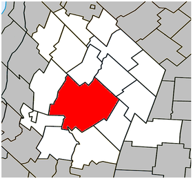
 Lage in der MRC Les Maskoutains | ||
Saint-Hyacinthe [] ist eine Stadt im Südwesten der kanadischen Provinz Québec. Sie liegt in der Verwaltungsregion Montérégie rund 60 km östlich von Montreal. Saint-Hyacinthe ist der Verwaltungssitz der regionalen Grafschaftsgemeinde (municipalité régionale du comté) Les Maskoutains, hat eine Fläche von 188,97 km² und zählt 55.648 Einwohner (Stand: 2016).
