Back Takapoto Azerbaijani Takapoto Catalan Atoll Takapoto CEB Takapoto English Takapoto Esperanto Takapoto (atolón) Spanish Takapoto Finnish Takapoto French Atol Takapoto Galician Takapoto Hungarian
| Takapoto | ||
|---|---|---|
 | ||
| Gewässer | Pazifischer Ozean | |
| Archipel | Tuamotu-Archipel | |
| Geographische Lage | 14° 37′ S, 145° 12′ W | |
|
| ||
| Anzahl der Inseln | – | |
| Hauptinsel | Okukina | |
| Landfläche | 15 km² | |
| Lagunenfläche | 81 km² | |
| Einwohner | 472 (2007) | |
 | ||
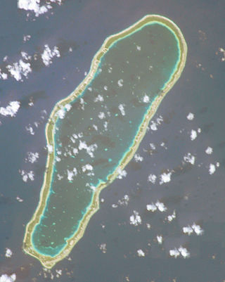
Takapoto, andere Namen: Tuapoto, Taapouta, Oura, alte Namen: het Eiland Daageraad (Roggeveen) oder Tagroth (Behrens), Spiridof (Kotzebue), ist ein flaches Korallenatoll in der Nordwestgruppe des Tuamotu-Archipels im Südpazifik. Geografisch zählt das Atoll zur Untergruppe der König-Georg-Inseln (Îles du Roi Georges). Die nächste bewohnte Insel ist Takaroa, 10 km im Nordosten gelegen.
