Back Thornton, Lancashire English Thornton (Lancashire) Spanish Thornton (Lancashire) Basque ثورنتون لانکاشر Persian Thornton, Lancashire Irish Thornton (Lancashire) Italian Thornton (Lancashire) LLD Thornton (Lancashire) Polish Thornton, Lancashire SIMPLE Thornton, Lancashire Swedish
| Thornton | ||
|---|---|---|
| Staat: | ||
| Koordinaten | 53° 52′ N, 3° 0′ W | |
| OS National Grid | SD339421 | |
|
| ||
| Traditionelle Grafschaft | Lancashire | |
| Verwaltung | ||
| Post town | THORNTON-CLEVELEYS | |
| Postleitzahlenabschnitt | FY5 | |
| Vorwahl | 01253 | |
| Landesteil | England | |
| Region | North West England | |
| Shire county | Lancashire | |
| District | Wyre | |
| Britisches Parlament | Wyre and Preston North | |
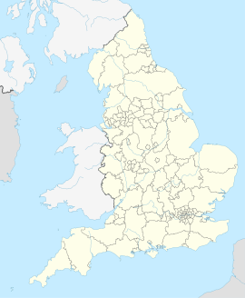
Thornton (gemeinsam mit dem benachbarten Dorf Cleveleys als Thornton-Cleveleys bekannt) ist ein Dorf in der Fylde in Lancashire, North West England und liegt etwa sechs Kilometer nördlich von Blackpool und drei Kilometer südlich von Fleetwood. Es liegt im Borough of Wyre. Die beiden Dörfer Thornton und Cleveleys sind durch die Victoria Road miteinander verbunden.
