Back Pazifische Taifunsaison 2005 German Temporada de tifones en el Pacífico de 2005 Spanish Saison cyclonique 2005 dans l'océan Pacifique nord-ouest French 2005年の台風 Japanese 2005년 태풍 Korean Tyfoonseizoen van de Grote Oceaan 2005 Dutch Temporada de tufões no Pacífico de 2005 Portuguese Mùa bão Tây Bắc Thái Bình Dương 2005 Vietnamese 2005年太平洋颱風季 Chinese
| 2005 Pacific typhoon season | |
|---|---|
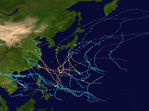
 Season summary map | |
| Seasonal boundaries | |
| First system formed | January 13, 2005 |
| Last system dissipated | December 21, 2005 |
| Strongest storm | |
| Name | Haitang |
| • Maximum winds | 195 km/h (120 mph) (10-minute sustained) |
| • Lowest pressure | 920 hPa (mbar) |
| Seasonal statistics | |
| Total depressions | 33 |
| Total storms | 23 official, 2 unofficial[a] |
| Typhoons | 13 |
| Super typhoons | 3 (unofficial) |
| Total fatalities | 650 total |
| Total damage | $9.74 billion (2005 USD) |
| Related articles | |
The 2005 Pacific typhoon season was the least active typhoon season since 2000, producing 23 named storms, of which 13 became typhoons (including 4 super typhoons). It was an event in the annual cycle of tropical cyclone formation, in which tropical cyclones form in the western Pacific Ocean. The season ran throughout 2005, though most tropical cyclones typically develop between May and October. The season's first named storm, Kulap, developed on January 13, while the season's last named storm, Bolaven, dissipated on November 20. The season's first typhoon, Haitang, reached typhoon status on July 13, and became the first super typhoon of the year three days later.
The scope of this article is limited to the Pacific Ocean, to the north of the equator between 100°E and the 180th meridian. Within the northwestern Pacific Ocean, there are two separate agencies that assign names to tropical cyclones, which can often result in a cyclone having two names, one from the JMA and one from PAGASA. The Japan Meteorological Agency (JMA) will name a tropical cyclone should it be judged to have 10-minute sustained wind speeds of at least 65 km/h (40 mph) anywhere in the basin, while the Philippine Atmospheric, Geophysical and Astronomical Services Administration (PAGASA) assigns names to tropical cyclones which move into or form as a tropical depression in their area of responsibility located between 135°E and 115°E and between 5°N–25°N regardless of whether or not a tropical cyclone has already been given a name by the JMA. Tropical depressions that are monitored by the United States' Joint Typhoon Warning Center (JTWC) are given a number with a "W" suffix.
- ^ "Đặc điểm Khí tượng Thủy văn 2005" [Hydro-meteorological characteristics in 2005] (PDF). National Center for Hydro-Meteorological Forecasting. Archived from the original (PDF) on 30 May 2024. Retrieved 2025-01-23.
Cite error: There are <ref group=lower-alpha> tags or {{efn}} templates on this page, but the references will not show without a {{reflist|group=lower-alpha}} template or {{notelist}} template (see the help page).