Back Zemětřesení na Jávě (červenec 2006) Czech Erdbeben vor Java Juli 2006 German Terremoto de Java de julio de 2006 Spanish زمینلرزه ژوئیه ۲۰۰۶ جاوه Persian Séisme de juillet 2006 à Java French 17 जुलाई 2006 जावा भूकंप Hindi Gempa bumi dan tsunami Jawa 2006 ID ジャワ島南西沖地震 Japanese Gempa bumi Jawa Julai 2006 Malay Zeebeving Java 2006 Dutch
 The beach and peninsula encompassing Pangandaran National Park | |
| UTC time | 2006-07-17 08:19:26 |
|---|---|
| ISC event | 10699442 |
| USGS-ANSS | ComCat |
| Local date | July 17, 2006 |
| Local time | 15:19 local time (WIB (Indonesia Western Standard Time)) |
| Duration | 185 seconds[1] |
| Magnitude | 7.7 Mw[2][3] |
| Depth | 25.3 km (15.7 mi)[2] |
| Epicenter | 9°20′S 107°19′E / 9.33°S 107.32°E[2] |
| Type | Thrust[1][4] |
| Areas affected | Southern Java, Indonesia |
| Total damage | $44.7 million[5] |
| Max. intensity | MMI IV (Light)[1][6] |
| Tsunami | 5–7 metres (16–23 ft), locally up to 21 metres (69 ft)[7] |
| Casualties | 668 dead, 9,299 injured, 65 missing[8][9] |
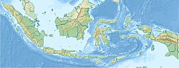
An earthquake occurred on July 17, 2006, at 15:19:27 local time along a subduction zone off the coast of west and central Java, a large and densely populated island in the Indonesian archipelago. The shock had a moment magnitude of 7.7 and a maximum perceived intensity of IV (Light) in Jakarta, the capital and largest city of Indonesia. There were no direct effects of the earthquake's shaking due to its low intensity, and the large loss of life from the event was due to the resulting tsunami, which inundated a 300 km (190 mi) portion of the Java coast that had been unaffected by the earlier 2004 Indian Ocean earthquake and tsunami that was off the coast of Sumatra. The July 2006 earthquake was also centered in the Indian Ocean, 180 kilometers (110 mi) from the coast of Java, and had a duration of more than three minutes.
An abnormally slow rupture at the Sunda Trench and a tsunami that was unusually strong relative to the size of the earthquake were both factors that led to it being categorized as a tsunami earthquake. Several thousand kilometers to the southeast, surges of several meters were observed in northwestern Australia, but in Java the tsunami runups (height above normal sea level) were typically 5–7 meters (16–23 ft) and resulted in the deaths of more than 600 people. Other factors may have contributed to exceptionally high peak runups of 10–21 m (33–69 ft) on the small and mostly uninhabited island of Nusa Kambangan, just to the east of the resort town of Pangandaran, where damage was heavy and a large loss of life occurred. Since the shock was felt with only moderate intensity well inland, and even less so at the shore, the surge arrived with little or no warning. Other factors contributed to the tsunami being largely undetected until it was too late, and although a tsunami watch was posted by an American tsunami warning center and a Japanese meteorological center, no information was delivered to people at the coast.
- ^ a b c Cite error: The named reference
Ammonwas invoked but never defined (see the help page). - ^ a b c Cite error: The named reference
ISC-GEMwas invoked but never defined (see the help page). - ^ Mori et al. 2010, p. 202
- ^ Cite error: The named reference
Kuenzawas invoked but never defined (see the help page). - ^ Cite error: The named reference
Muhariwas invoked but never defined (see the help page). - ^ Cite error: The named reference
Mori_p203was invoked but never defined (see the help page). - ^ Cite error: The named reference
Fritzwas invoked but never defined (see the help page). - ^ Cite error: The named reference
Yuliantowas invoked but never defined (see the help page). - ^ Cite error: The named reference
Reesewas invoked but never defined (see the help page).

