Back أبفيل (كارولاينا الجنوبية) Arabic ابفيل (ابفيل) ARZ ابیویل، گونئی کارولینا AZB Abbeville (Carolina del Sud) Catalan Эббивиль (Къилба Каролина) CE Abbeville (kapital sa kondado sa Tinipong Bansa, South Carolina) CEB Abbeville (Jižní Karolína) Czech Abbeville, De Carolina Welsh Abbeville (South Carolina) German Abbeville (Carolina del Sur) Spanish
Abbeville, South Carolina | |
|---|---|
 Abbeville Opera House (2003) | |
| Coordinates: 34°10′42.7584″N 82°22′39.6732″W / 34.178544000°N 82.377687000°W | |
| Country | United States |
| State | South Carolina |
| County | Abbeville |
| Government | |
| • Mayor | Trey Edwards |
| Area | |
• Total | 6.23 sq mi (16.13 km2) |
| • Land | 6.21 sq mi (16.10 km2) |
| • Water | 0.01 sq mi (0.03 km2) |
| Elevation | 594 ft (181 m) |
| Population | |
• Total | 4,874 |
| • Density | 784.23/sq mi (302.77/km2) |
| Time zone | UTC−5 (Eastern (EST)) |
| • Summer (DST) | UTC−4 (EDT) |
| ZIP code | 29620 |
| Area codes | 864, 821 |
| FIPS code | 45-00100[4] |
| GNIS feature ID | 1244839[2] |
| Website | www |
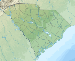
Abbeville is a city and county seat of Abbeville County, in the U.S. state of South Carolina.[5][6] It is located 86 miles (138 km) west of Columbia and 45 miles (72 km) south of Greenville.[7] Its population was 5,237 at the 2010 census.[4] Settled by French Huguenot settlers, it was named, along with the county, for the French town of the same name.[7][8]
- ^ "ArcGIS REST Services Directory". United States Census Bureau. Retrieved October 15, 2022.
- ^ a b U.S. Geological Survey Geographic Names Information System: Abbeville, South Carolina
- ^ Cite error: The named reference
USCensusDecennial2020CenPopScriptOnlywas invoked but never defined (see the help page). - ^ a b Anon 2014
- ^ Anon 2014a
- ^ Hoiberg 2010, p. 11
- ^ a b Cite error: The named reference
Collierswas invoked but never defined (see the help page). - ^ Gannett 1905, p. 22


