Back أكتون (لندن) Arabic اكتون (بلده فى ايلنج) ARZ آکتون، لندن AZB Актън Bulgarian Acton (Londres) Catalan Acton (lungsod sa Hiniusang Gingharian, Inglatera, Greater London) CEB Acton, Llundain Welsh Acton (London) Danish Acton (Londres) Spanish Acton (Londres) Basque
| Acton | |
|---|---|
 Acton Town Hall, built for Acton Urban District and opened 10 March 1910 | |
Location within Greater London | |
| Area | 9.20 km2 (3.55 sq mi) |
| Population | 62,480 [1] |
| • Density | 6,791/km2 (17,590/sq mi) |
| OS grid reference | TQ205805 |
| • Charing Cross | 6.1 mi (9.8 km) W |
| London borough | |
| Ceremonial county | Greater London |
| Region | |
| Country | England |
| Sovereign state | United Kingdom |
| Post town | LONDON |
| Postcode district | W3, W4, W12 |
| Postcode district | NW10 |
| Dialling code | 020 |
| Police | Metropolitan |
| Fire | London |
| Ambulance | London |
| UK Parliament | |
| London Assembly | |

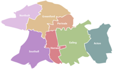
Acton (/ˈæktən/) is a town in West London, England, within the London Borough of Ealing. It is 6.1 miles (10 km) west of Charing Cross.
At the 2011 census, its four wards, East Acton, Acton Central, South Acton and Southfield, had a population of 62,480, a ten-year increase of 8,791 people.[2] North Acton, West Acton, East Acton, South Acton, Acton Green, Acton Town, Acton Vale and Acton Central are all parts of Acton.
Acton means "oak farm" or "farm by oak trees", and is derived from the Old English āc (oak) and tūn (farm).[3][4] Originally an ancient village, as London expanded, Acton was absorbed into the city. Since 1965, Acton equates to the east of the London Borough of Ealing, though some of East Acton is in the London Borough of Hammersmith and Fulham and a small portion of South Acton is in the London Borough of Hounslow.
Central Acton is synonymous with the hub of commerce and retail on the former main road between London and Oxford (the Uxbridge Road); a reminder of its history is in its inns, which in some cases date back to the late Tudor period as stopping places for travellers. Nowadays, the principal route linking London and Oxford (the A40 dual carriageway) bypasses central Acton, but passes through East Acton and North Acton.
- ^ Key Statistics; Quick Statistics: Population Density Archived 11 February 2003 at the Wayback Machine United Kingdom Census 2011 Office for National Statistics Retrieved 31 October 2014
- ^ "Key Statistics; Quick Statistics: Population Density" Archived 11 February 2003 at the Wayback Machine. United Kingdom Census 2011. Office for National Statistics. Retrieved 31 October 2014.
- ^ Mills, A.D. (2010). A Dictionary of London Place-Names. Oxford University Press. p. 2. ISBN 9780199566785.
- ^ Cite error: The named reference
growthwas invoked but never defined (see the help page).
