Back مقاطعة ألين (لويزيانا) Arabic Allen Parish, Louisiana BAR অ্যালেন পারিশ, লুইসিয়ানা BPY Allen Gông (Louisiana) CDO Аллен (кӀошт, Луизиана) CE Allen Parish CEB Allen Parish, Louisiana Welsh Allen Parish German Parroquia de Allen Spanish Alleni vald Estonian
Allen Parish | |
|---|---|
 Allen Parish Courthouse in Oberlin (near sunset) | |
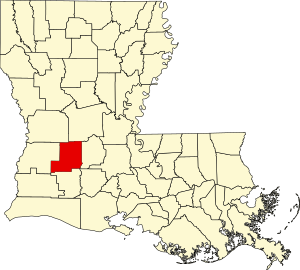
 Location within the U.S. state of Louisiana | |
 Louisiana's location within the U.S. | |
| Coordinates: 30°40′N 92°50′W / 30.66°N 92.83°W | |
| Country | |
| State | |
| Founded | 1912 |
| Named for | Henry Watkins Allen |
| Seat | Oberlin |
| Largest city | Oakdale |
| Area | |
• Total | 766 sq mi (1,980 km2) |
| • Land | 762 sq mi (1,970 km2) |
| • Water | 4.1 sq mi (11 km2) 0.5% |
| Population (2020) | |
• Total | 22,750 |
| • Density | 30/sq mi (11/km2) |
| Time zone | UTC−6 (Central) |
| • Summer (DST) | UTC−5 (CDT) |
| Area code | |
| Congressional district | 4th |
| Website | www |
Allen Parish (French: Paroisse d'Allen) is a parish located in the U.S. state of Louisiana. As of the 2020 census, the population was 22,750.[1] The parish seat is Oberlin and the largest city is Oakdale.[2] Allen Parish is in southwestern Louisiana, southwest of Alexandria.
Allen Parish is named for former Confederate States Army general and Governor of Louisiana Henry Watkins Allen. It was separated in 1912 from the larger Calcasieu Parish to the southwest.
- ^ "Census - Geography Profile: Allen Parish, Louisiana". United States Census Bureau. Retrieved January 21, 2023.
- ^ "Find a County". National Association of Counties. Archived from the original on May 31, 2011. Retrieved June 7, 2011.

