Almaguin Highlands | |
|---|---|
Inter-region | |
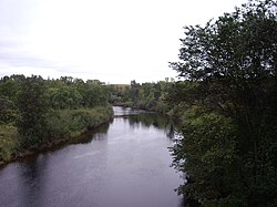
 Magnetawan River looking downstream from the Highway 11 bridge in Burk's Falls | |
| Nickname(s): Almaguin; the Highlands | |
| Coordinates: 45°48′N 079°36′W / 45.800°N 79.600°W | |
| Country | Canada |
| Province | Ontario |
| Region | Central Ontario |
| District | Parry Sound |
| Government | |
| • MPs | Scott Aitchison, Anthony Rota |
| • MPPs | Graydon Smith, Vic Fedeli |
| Area | |
• Total | 5,236.58 km2 (2,021.85 sq mi) |
| Population (2016) | |
• Total | 23,929 |
| • Density | 4.6/km2 (12/sq mi) |
| Time zone | UTC-5 (EST) |
| • Summer (DST) | UTC-4 (EDT) |
| Postal code FSA | P0A, P0H |
| Area code | 705 |
The Almaguin Highlands Region (colloquially known as Almaguin, also referred to as 'the Highlands') in Ontario, Canada, covers approximately 5,200 km2 (2,000 sq mi) comprising the eastern half of Parry Sound District. It is bounded by Muskoka in the south, and by Lake Nipissing and Nipissing District in the north. The eastern edge abuts the western boundary of Algonquin Provincial Park, whereas the western boundary of the Almaguin Highlands is generally regarded to be the mid east-west point of Parry Sound District. Originally derived from the words Algonquin, Magnetawan, and Seguin.[1] the name Almaguin is now used to describe the marketing region of East Parry Sound.

