Back আলমোড়া Bengali/Bangla আলমোরা BPY Almora Catalan Almora (lungsod) CEB Almora German Almora Spanish المورا Persian Almora Finnish Almora French અલમોડા Gujarati
Almora | |
|---|---|
Town | |
 View of Almora in 2013 | |
| Nicknames: Cultural Capital of Kumaon, Heart of Kumaon | |
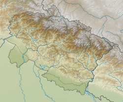
| Coordinates: 29°35′50″N 79°39′33″E / 29.5971°N 79.6591°E | |
| Country | |
| State | Uttarakhand |
| Division | Kumaon |
| District | Almora |
| Established | 1568 |
| Founded by | Balo Kalyan Chand |
| Government | |
| • Type | Mayor–Council |
| • Mayor | Prakash Joshi[1] |
| Area | |
• Total | 16.60 km2 (6.41 sq mi) |
| Elevation | 1,642 m (5,387 ft) |
| Population (2011)[2] | |
• Total | 35,513 |
| • Density | 2,100/km2 (5,500/sq mi) |
| Demonym | Almoran (English) Almoradi(Kumaoni) |
| Languages | |
| • Official | Hindi Sanskrit |
| • Native | Kumaoni |
| Time zone | UTC+5:30 (IST) |
| PIN | 263601[3] |
| Telephone code | 91-5962 |
| Vehicle registration | UK-01 |
| Sex ratio | 1142 ♂/♀ |
| Climate | Alpine (BSh) and Humid subtropical(Cwb) (Köppen) |
| Avg. annual temperature | −3 to 28 °C (27 to 82 °F) |
| Avg. summer temperature | 12 to 28 °C (54 to 82 °F) |
| Avg. winter temperature | −3 to 15 °C (27 to 59 °F) |
| Website | almora |
Almora (Kumaoni: Almāḍ) is a municipal corporation and a cantonment town in the state of Uttarakhand, India. It is the administrative headquarters of Almora district.[4] Almora is located on a ridge at the southern edge of the Kumaon Hills of the Himalaya range. The Koshi (Kaushiki) and Suyal (Salmale) rivers flow along the city and snow-capped Himalayas can be seen in the background.
Almora was founded in 1568.[5] by King Kalyan Chand;[6][7][8] however, there are accounts of human settlements in the hills and surrounding region in the Hindu epic Mahabharata[9] (8th and 9th century BCE[10]). Almora was the seat of Chand kings that ruled over the Kumaon Kingdom. It is considered the cultural heart of the Kumaon region of Uttarakhand.
According to the provisional results of the 2011 Census of India, Almora had a population of about 179,000.[citation needed] Nestled within higher peaks of the Himalaya, Almora enjoys a year-round mild temperate climate. The town is visited by thousands of tourists annually from all over the world.[citation needed] There are 11 blocks (i.e. VikashKhand) in Almora district.[citation needed]
- ^ List of Elected Mayor/Chairpersons of Uttarakhand (PDF). Lucknow: RCUES. 2008. Retrieved 31 August 2016.
- ^ Cite error: The named reference
dchbwas invoked but never defined (see the help page). - ^ "Almora Pin Code". pin-code.net. Archived from the original on 2 November 2020. Retrieved 2 November 2020.
- ^ Gopal, Madan (1990). K.S. Gautam (ed.). India through the ages. Publication Division, Ministry of Information and Broadcasting, Government of India. p. 174.
- ^ Trivedi, Vijaya R. (1995). Autonomy of Uttarakhand. Mohit Publications. p. 33. ISBN 9788174450081.
- ^ Sharma, Man Mohan. Through the valley of gods: travels in the central Himalayas. Vision Books. p. 99.
- ^ Bhattacherje, S. B. (May 2009). Encyclopaedia of Indian Events & Dates. Sterling Publishers Pvt. Ltd. p. 55. ISBN 9788120740747.
- ^ Tyagi, Nutan (1991). Hill Resorts of U.P. Himalaya,: A Geographical Study. Indus Publishing. p. 76. ISBN 9788185182629.
- ^ Debroy, Bibek (July 2012). The Mahabharata: Volume 3. Penguin Books India. p. 20. ISBN 9780143100157.
- ^ Brockington, J. L. (1998). The Sanskrit Epics. BRILL. p. 26. ISBN 9004102604.

