Back Амел Bulgarian Amel (kumun) Breton Amel Catalan Amblève (parokya) CEB Amel (Belgien) Danish Amel German Amel (Belgio) Esperanto Amel Spanish Amel Basque امل (بلژیک) Persian
This article needs additional citations for verification. (March 2013) |
Amel
Amblève (French) | |
|---|---|
 | |
| Coordinates: 50°21′N 06°10′E / 50.350°N 6.167°E | |
| Country | |
| Community | |
| Region | Wallonia |
| Province | |
| Arrondissement | Verviers |
| Government | |
| • Mayor | Erik Wiesemes (SP) (GI) |
| • Governing party/ies | GemeindeInteressen (GI) |
| Area | |
• Total | 125.88 km2 (48.60 sq mi) |
| Population (2018-01-01)[1] | |
• Total | 5,480 |
| • Density | 44/km2 (110/sq mi) |
| Postal codes | 4770-4771 |
| NIS code | 63001 |
| Area codes | 080 |
| Website | www.amel.be |
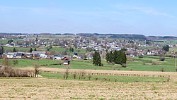
Amel (German pronunciation: [aːml̩]; French: Amblève, French pronunciation: [ɑ̃blɛv]) is a Belgian municipality in the Walloon province of Liège, and is part of the German-speaking Community of Belgium (German: Deutschsprachige Gemeinschaft Belgiens). On January 1, 2013, the municipality of Amel had a total population of 5,466. The total area is 125.15 km2 which gives a population density of 44 inhabitants per km2.
The name Amel is of Celtic origin and means water. The river Amblève (German: Amel) flows through the municipality.
Amel is the birthplace of Karl-Heinz Lambertz, former leader (Minister-President) of the community executive of the German-speaking community of Belgium.
- ^ "Wettelijke Bevolking per gemeente op 1 januari 2018". Statbel. Retrieved 9 March 2019.


