Back Arabia (Gradfeld) German Arabia (cuadrángulo) Spanish Quadrangle d'Arabia French अरेबिया चतुष्कोण Hindi Maglia Arabia Italian Arabia (Gradsecteur) LB Quadrângulo de Arabia Portuguese Cuadràngoło de Arabia VEC 阿拉伯方格区 Chinese
 Map of Arabia quadrangle from Mars Orbiter Laser Altimeter (MOLA) data. The highest elevations are red and the lowest are blue. | |
| Coordinates | 15°00′N 337°30′W / 15°N 337.5°W |
|---|---|

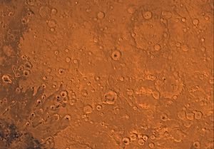
The Arabia quadrangle is one of a series of 30 quadrangle maps of Mars used by the United States Geological Survey (USGS) Astrogeology Research Program. The Arabia quadrangle is also referred to as MC-12 (Mars Chart-12).[1]
The quadrangle contains part of the classic area of Mars known as Arabia. It also contains a part of Terra Sabaea and a small part of Meridiani Planum. It lies on the boundary between the young northern plains and the old southern highlands. The quadrangle covers the area from 315° to 360° west longitude and 0° to 30° north latitude.
- ^ Davies, M.E.; Batson, R.M.; Wu, S.S.C. "Geodesy and Cartography" in Kieffer, H.H.; Jakosky, B.M.; Snyder, C.W.; Matthews, M.S., Eds. Mars. University of Arizona Press: Tucson, 1992.