Back أشاروكين (نيويورك) Arabic Asharoken Catalan Asharoken CEB Asharoken, Efrog Newydd Welsh Asharoken Spanish Asharoken (New York) Basque Asharoken French اشاروکن (نيۊیؤرک) GLK Asharoken, New York HT Asharoken Italian
Asharoken, New York | |
|---|---|
| Incorporated Village of Asharoken | |
 Asharoken Road in the village on October 9, 2022. | |
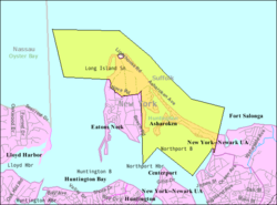
 U.S. Census map of Asharoken | |
| Coordinates: 40°56′15″N 73°23′0″W / 40.93750°N 73.38333°W | |
| Country | |
| State | |
| County | Suffolk |
| Town | Huntington |
| Incorporated | 1925 |
| Named for | Chief Asharoken |
| Government | |
| • Mayor | Gregory Letica |
| Area | |
• Total | 6.48 sq mi (16.80 km2) |
| • Land | 1.42 sq mi (3.68 km2) |
| • Water | 5.06 sq mi (13.11 km2) |
| Elevation | 13 ft (4 m) |
| Population (2020) | |
• Total | 592 |
| • Density | 416.32/sq mi (160.71/km2) |
| Time zone | UTC-5 (Eastern (EST)) |
| • Summer (DST) | UTC-4 (EDT) |
| ZIP Code | 11768 |
| Area code(s) | 631, 934 |
| FIPS code | 36-02737 |
| GNIS feature ID | 0942621 |
Asharoken is a village in the Town of Huntington in Suffolk County, on the North Shore of Long Island in New York. The population was 654 at the 2010 census.
- ^ "ArcGIS REST Services Directory". United States Census Bureau. Retrieved September 20, 2022.

