Back Aughrim (Galway) Catalan Aughrim (lungsod sa Connaught) CEB Aughrim (County Galway) German Aughrim (Galway konderria) Basque Aughrim (comté de Galway) French Eachroim, Contae na Gaillimhe Irish Aughrim Italian ოხრიმი Georgian Agrimum Latin Aughrim (Galway) Polish
Aughrim
Eachroim | |
|---|---|
Village | |
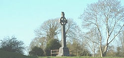
 Aughrim cross | |
| Coordinates: 53°18′15″N 8°19′00″W / 53.304167°N 8.316667°W | |
| Country | Ireland |
| Province | Connacht |
| County | County Galway |
| Elevation | 115 m (377 ft) |
| Population (2011)[1] | |
| • Rural | 595 |
| Time zone | UTC+0 (WET) |
| • Summer (DST) | UTC+1 (IST (WEST)) |
| Irish Grid Reference | M785281 |
| Website | www |
Aughrim (Irish: Eachroim, meaning 'horse ridge')[2] is a small village in County Galway, Ireland. It is located between the towns of Loughrea and Ballinasloe, along the old N6 national primary road (now listed as the R446 regional road) that used to be the main road between Galway and Dublin. According to the Irish census of 2011, the division had a population of 595. The village is in a civil parish of the same name.[3]
It was in Aughrim that the Marquis de St Ruth prepared the Irish Catholic Jacobite troops for the Battle of Aughrim which was fought, during the Williamite war in Ireland, on 12 July 1691. Two ringforts located to the south (in Attidermot townland) are a National Monument.
- ^ "Census 2011 – Population Classified by Area Table 6 Population of each province, county, city, urban area, rural area and electoral division, 2006 and 2011" (PDF).
- ^ Field, John (1980). Place-names of Great Britain and Ireland. Newton Abbot, Devon: David & Charles. p. 27. ISBN 0389201545. OCLC 6964610.
- ^ "Eachroim/Aughrim". Placenames Database of Ireland. Retrieved 4 January 2025.
