Back عين غزال (حيفا) Arabic عين غزال ARZ ʿAin Ghazal (Palästina) German עין ע'זאל HE Ayn Ghazal ID Ajn Ghazal Polish عین غزال، حیفا Urdu
Ayn Ghazal
عين غزال 'Ain Ghazal, 'Ein Ghazal | |
|---|---|
Village | |
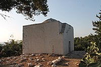
 The Maqam (shrine) of Sheikh Shahada | |
| Etymology: "Spring of the gazelle"[1] | |
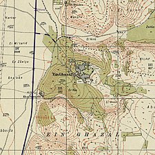
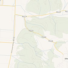
A series of historical maps of the area around Ayn Ghazal (click the buttons) | |
Location within Mandatory Palestine | |
| Coordinates: 32°37′55″N 34°58′03″E / 32.63194°N 34.96750°E | |
| Palestine grid | 147/226 |
| Geopolitical entity | Mandatory Palestine |
| Subdistrict | Haifa |
| Date of depopulation | July 24–26, 1948[4] |
| Area | |
• Total | 14,628 dunams (14.628 km2 or 5.648 sq mi) |
| Population (1945) | |
• Total | 2,170[2][3] |
| Cause(s) of depopulation | Military assault by Yishuv forces |
| Current Localities | Ein Ayala?[5]Ofer |
Ayn Ghazal (Arabic: عين غزال, "Spring of the Gazelle") was a Palestinian Arab village located 21 kilometers (13 mi) south of Haifa. Depopulated during the 1948 Arab-Israeli War as a result of an Israeli military assault during Operation Shoter, the village was then completely destroyed. Incorporated into the State of Israel, it is now mostly a forested area. The Israeli moshav of Ofer ("fawn") was established in 1950 on part of the former village's lands. Ein Ayala, a moshav established in 1949, lies just adjacent; its name being the Hebrew translation of Ayn Ghazal.[6]
- ^ Palmer, 1881, p. 142
- ^ Government of Palestine, Department of Statistics, 1945, p. 13
- ^ a b Government of Palestine, Department of Statistics. Village Statistics, April, 1945. Quoted in Hadawi, 1970, p. 47
- ^ Morris, 2004, p. xviii, village #166. Also gives cause of depopulation.
- ^ Morris, 2004, p. xxii, settlement #118
- ^ Bronstein in Masalha, 2005, p. 233.


