Back বাইক্সো গুৱানডু BPY Байшу-Гуанду CE Baixo Guandu (munisipyo) CEB Baixo Guandu German Baixo Guandu Esperanto Baixo Guandú Spanish Baixo Guandu Basque Baixo Guandu French Բայշու Գուանդու Armenian Baixo Guandu Italian
Baixo Guandu | |
|---|---|
| The Municipality of Baixo Guandu do Espírito Santo | |
 Igreja da Matriz | |
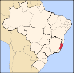
 Location in the State of Espírito Santo | |
 | |
| Coordinates: 19°31′08″S 41°00′57″W / 19.51889°S 41.01583°W | |
| Country | |
| Region | Southeast |
| State | |
| Founded | June 8, 1935 |
| Government | |
| • Mayor | Lastênio Luiz Cardoso (2009-2012) |
| Area | |
• Total | 917.88 km2 (354.40 sq mi) |
| Population (2020 [1]) | |
• Total | 31,132 |
| • Density | 31.11/km2 (80.6/sq mi) |
| Demonym | Guanduense |
| Time zone | UTC−3 (BRT) |
| Postal Code | 29730-000 |
| HDI (2000) | 0.71 – medium |
| Celebration day | April 10 |
| Website | www |
Baixo Guandu is a municipality located in the Brazilian state of Espírito Santo that was founded on April 10, 1935 and established as a city on June 8, same year. The city's celebration day is April 10. Its population was 31,132 (2020) and its area is 918 km². The area is most well known for its exports of coffee, especially from the high mountains of the district of Alto Mutum Preto. The main watercourse through the municipality is the Rio Doce river ("Doce" means sweet in Portuguese) whose basin (of 83,500 square kilometers) is composed of 222 municipalities.

