Back مطار باتل ماونتن ARZ Battle Mountain Airport CEB فرودگاه بتل ماونتن Persian Daʼahigą́dziildi chidí naatʼaʼí ńdinibįįhígi NV Aeroportul Battle Mountain Romanian Фурудгоҳи Бетл Маунтен Tajik بیٹل ماؤنٹین ہوائی اڈا Urdu
Battle Mountain Airport | |||||||||||||||
|---|---|---|---|---|---|---|---|---|---|---|---|---|---|---|---|
 | |||||||||||||||
| Summary | |||||||||||||||
| Airport type | Public | ||||||||||||||
| Operator | Lander County | ||||||||||||||
| Serves | Battle Mountain, Nevada | ||||||||||||||
| Location | Lander County, near Battle Mountain, Nevada | ||||||||||||||
| Elevation AMSL | 4,532 ft / 1,381 m | ||||||||||||||
| Coordinates | 40°35′59″N 116°52′34″W / 40.59972°N 116.87611°W | ||||||||||||||
 | |||||||||||||||
| Runways | |||||||||||||||
| |||||||||||||||
| Helipads | |||||||||||||||
| |||||||||||||||

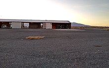
Battle Mountain Airport (IATA: BAM, ICAO: KBAM, FAA LID: BAM), also known as Lander County Airport, is 3 miles (5 km) southeast of Battle Mountain, Nevada, United States. This general aviation airport is owned by Lander County and operated by the Battle Mountain Airport Authority.