| Beaver Creek Valley State Park | |
|---|---|
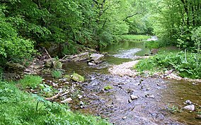
 East Beaver Creek, a spring-fed trout stream, has carved the narrow Beaver Creek Valley. | |
| Location | Houston, Minnesota, United States |
| Coordinates | 43°39′0″N 91°34′58″W / 43.65000°N 91.58278°W |
| Area | 1,187 acres (4.80 km2) |
| Elevation | 833 ft (254 m)[1] |
| Established | 1937 |
| Governing body | Minnesota Department of Natural Resources |
Beaver Creek Valley State Park is a state park of Minnesota, United States, featuring a steep, narrow valley carved by East Beaver Creek. This spring-fed stream is a fishing destination for its native brook trout, and introduced brown trout. The park rests on a heavily forested valley, up to 250 feet (76 m) deep in places, amidst the farmland of southeastern Minnesota. Located near the town of Caledonia, the park was developed in the 1930s by the Works Progress Administration. The parkland exhibits the highly stream-carved terrain characteristic of the Driftless Area.
- ^ "Beaver Creek Valley State Park". Geographic Names Information System. United States Geological Survey. January 11, 1980. Retrieved February 23, 2011.


