Back Blou-Nyl Afrikaans ጥቁር አባይ Amharic النيل الأزرق Arabic نهر النيل الازرق ARZ Ríu Nilu Azul AST Mavi Nil Azerbaijani گؤی نیل چایی AZB Зәңгәр Нил Bashkir Tukad Nil Pelung BAN Блакітны Ніл Byelorussian
| Blue Nile Abay | |
|---|---|
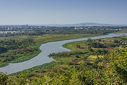
 Blue Nile River in Ethiopia | |
 | |
| Location | |
| Countries | Ethiopia, Sudan |
| Physical characteristics | |
| Source | Gilgel Abay |
| • location | Sekela, Ethiopia |
| • coordinates | 11°00′07″N 37°13′30″E / 11.002°N 37.225°E |
| • elevation | 2,560 m (8,400 ft) |
| Mouth | Nile River |
• location | Khartoum, Sudan |
• coordinates | 15°38′31″N 32°30′18″E / 15.642°N 32.505°E |
• elevation | 373 m (1,224 ft) |
| Length | 1,450 km (900 mi) |
| Basin size | 325,000 km2 (125,000 sq mi) |
| Discharge | |
| • average | 1,548 m3/s (54,700 cu ft/s) |
| Basin features | |
| Progression | Nile → Mediterranean Sea |
| River system | Nile |
| Tributaries | |
| • left | Bashilo, Walaqa, Jamma, Muger, Guder, Gulla, Didessa, Dabus |
| • right | Beles, Dinder, Rahad |
The Blue Nile[note 1] is a river originating at Lake Tana in Ethiopia. It travels for approximately 1,450 km (900 mi) through Ethiopia and Sudan. Along with the White Nile, it is one of the two major tributaries of the Nile and supplies about 85.6% of the water to the Nile during the rainy season.
Cite error: There are <ref group=note> tags on this page, but the references will not show without a {{reflist|group=note}} template (see the help page).