Back Blunsdon Afrikaans Blunsdon CEB Blunsdon French Blunsdon Polish Blunsdon SCO Blunsdon Swedish Blunsdon Turkish
| Blunsdon | |
|---|---|
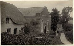
 Chapel Hill, Blunsdon ca.1920 | |
Location within Wiltshire | |
| Population | 2,714 (parish, 2021)[1] |
| OS grid reference | SU154902 |
| Civil parish |
|
| Unitary authority | |
| Ceremonial county | |
| Region | |
| Country | England |
| Sovereign state | United Kingdom |
| Post town | Swindon |
| Postcode district | SN25, SN26 |
| Dialling code | 01793 |
| Police | Wiltshire |
| Fire | Dorset and Wiltshire |
| Ambulance | South Western |
| UK Parliament | |
| Website | Parish Council |
Blunsdon is a civil parish in the Borough of Swindon, in Wiltshire, England, about 4 miles (6 km) north of the centre of Swindon, with the A419 forming its southern boundary. Its main settlement is the village of Broad Blunsdon, with Lower Blunsdon nearby; the hamlet of Broadbush is now contiguous with Broad Blunsdon.
Blunsdon is the eastern half of the former Blunsdon St Andrew civil parish. In April 2017, that parish was divided and the western half became a new St Andrews parish.
- ^ "Blunsdon (parish): population statistics". CityPopulation.de. Retrieved 23 April 2023.
