Back بوروفو Arabic Borovo (Hrvatska) BS Borovo (lungsod sa Krowatiya) CEB Borovo Czech Borovo Welsh Borovo German Borovo (Croacia) Spanish Borovo Basque Borovo Selo Finnish Borovo (Croatie) French
Borovo
Borovo Selo - Борово Село | |
|---|---|
| Borovo Municipality Općina Borovo Општина Борово[2] | |
|
Clockwise, from top: Church of St. Stephen, Borovo, side street grafiti, Radio Borovo entrance, Sloga football club's field, Borovo Elementary School, Danube, World War II memorial plaque by women of Borovo (1946), Municipal building central image: World War II memorial (1967) | |
 | |
| Coordinates: 45°23′N 18°58′E / 45.383°N 18.967°E | |
| Country | |
| Region | Podunavlje |
| County | |
| Government | |
| • Municipal mayor | Zoran Baćanović (SDSS) |
| Area | |
| 28.2 km2 (10.9 sq mi) | |
| • Urban | 28.2 km2 (10.9 sq mi) |
| Population (2021)[4] | |
| 3,555 | |
| • Density | 130/km2 (330/sq mi) |
| • Urban | 3,555 |
| • Urban density | 130/km2 (330/sq mi) |
| Demonym(s) | Serbo-Croatian: Borovčanin (♂) Borovčanka (♀) (per grammatical gender) |
| Time zone | UTC+1 (CET) |
| • Summer (DST) | UTC+2 (CEST) |
| Postal code | 32227 Borovo |
| Area code | +032 |
| Vehicle registration | VU |
| Official languages | Croatian, Serbian[5] |
| Website | opcina-borovo |
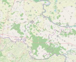
Borovo (Serbian Cyrillic: Борово,[6] Hungarian: Boró, German: Worow), also known as Borovo Selo (Serbian Cyrillic: Борово Село; lit. 'Borovo Village'; to distinguish it from Borovo Naselje suburb which up until 1980 was also a part of the Borovo cadastral municipality), is a village and a municipality in Vukovar-Syrmia County in eastern part of Croatia. Situated on the banks of the Danube river, it shares its border with Serbia and the municipality of Bač on the opposite side. The historical development of Borovo is intricately linked with the Danube, which has played a pivotal role in its development as a notable industrial hub in the region.
The etymological genesis of the toponym "Borovo" stems from the Serbo-Croatian word "bor" which signifies "pines." Despite functioning independently as a municipality in its own right, Borovo is closely related with the neighbouring town of Vukovar. The two are physically connected with Borovo effectively functions as a satellite town of Vukovar. Borovo stands as the most populous settlement in Croatia where the majority of residents are Serbs of Croatia. It's Serb community also ranks as the second-largest Serbian community in the county, coming after the Serbian community in Vukovar itself.
During the early 1990s, Borovo was affected by escalating interethnic tensions in the Socialist Republic of Croatia. This volatile atmosphere culminated in the 1991 Battle of Borovo Selo, one of the first armed clashes in the conflict which became known as the Croatian War of Independence. Borovo became a part of the self-proclaimed unrecognized SAO Eastern Slavonia, Baranja and Western Syrmia within the self-declared proto-state Republic of Serbian Krajina until 1995. Since the end of the war and the UNTAES transition, Borovo is one of the municipalities which according to the 1995 Erdut Agreement elect its representatives to the Joint Council of Municipalities, a consultative body of Serb minority's cultural autonomy in the region.
- ^ Cite error: The named reference
Prijedlog izvještajawas invoked but never defined (see the help page). - ^ Cite error: The named reference
Statutwas invoked but never defined (see the help page). - ^ Register of spatial units of the State Geodetic Administration of the Republic of Croatia. Wikidata Q119585703.
- ^ "Population by Age and Sex, by Settlements" (xlsx). Census of Population, Households and Dwellings in 2021. Zagreb: Croatian Bureau of Statistics. 2022.
- ^ Četvrto izvješće Republike Hrvatske o primjeni Europske povelje o regionalnim ili manjinskim jezicima, page 60, Zagreb, 2009 (in Croatian).
- ^ "Minority names in Croatia: Registar Geografskih Imena Nacionalnih Manjina Republike Hrvatske" (PDF) (in Croatian). Archived from the original (PDF) on 29 October 2013. Retrieved 2 May 2015.


