| Boundary Waters Canoe Area Wilderness | |
|---|---|
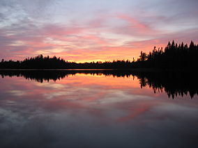
 Sunset over Pose Lake, a small lake accessible only by foot. | |
| Location | Cook, Lake, Saint Louis counties, Minnesota, United States |
| Nearest city | Ely, Minnesota Grand Marais, Minnesota |
| Coordinates | 48°N 91°W / 48°N 91°W |
| Area | 1,090,000 acres (4,400 km2)[1] |
| Established | 1978 |
| Visitors | 105,000 (in 2015) |
| Governing body | U.S. Forest Service |
The Boundary Waters Canoe Area Wilderness (BWCAW or BWCA) comprises 1,090,000 acres (440,000 ha) of pristine forests, glacial lakes, and streams in the Superior National Forest. Located entirely within the U.S. state of Minnesota at the Boundary Waters, the wilderness area is under the administration of the United States Forest Service. Efforts to preserve the primitive landscape began in the 1900s and culminated in the Boundary Waters Canoe Area Wilderness Act of 1978. The area is a popular destination for canoeing, hiking, and fishing, and is the most visited wilderness in the United States.[2]: 10
- ^ "Land Area Report". U.S. Forest Service. 2004. Retrieved August 28, 2006.
- ^ Cite error: The named reference
tripguidewas invoked but never defined (see the help page).

