Back Брод (град в Република Сръбска) Bulgarian Brod (općina) BS Brod (Bòsnia i Hercegovina) Catalan Brod (Bosna a Hercegovina) Czech Bosanski Brod German Bosanski Brod Spanish برود (بوسنی و هرزگوین) Persian Brod (Bosnie-Herzégovine) French Bosanski Brod Croatian Բրոդ (Բոսնիա և Հերցեգովինա) Armenian
Brod
Брод Bosanski Brod | |
|---|---|
Town and municipality | |
 Brod | |
 Location of Brod within Bosnia and Herzegovina | |
 | |
| Coordinates: 45°08′N 17°59′E / 45.133°N 17.983°E | |
| Country | |
| Entity | |
| Geographical region | Posavina |
| Government | |
| • Municipal mayor | Milan Zečević (SNSD) |
| • Municipality | 229.3 km2 (88.5 sq mi) |
| Population (2013 census) | |
| • Town | 8,563 |
| • Municipality | 16,619 |
| • Municipality density | 72/km2 (190/sq mi) |
| Time zone | UTC+1 (CET) |
| • Summer (DST) | UTC+2 (CEST) |
| Area code | 53 |
| Website | www |


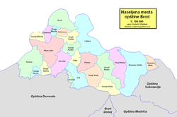
Brod (Serbian Cyrillic: Брод, pronounced [brôːd]),[1] formerly Bosanski Brod (Serbian Cyrillic: Босански Брод) and Srpski Brod (Serbian Cyrillic: Српски Брод), is a town and municipality in Republika Srpska, Bosnia and Herzegovina. It is situated on the south bank of the river Sava, in the western part of the Posavina region.[2] As of 2013, the town has a population of 7,637 inhabitants, while the municipality has a population of 16,619 inhabitants.
- ^ The official web site of the municipality Archived 2013-11-26 at the Wayback Machine, Brod/Брод.
- ^ The official name of region Archived 2015-06-07 at the Wayback Machine
