Back بوکیت پنجنگ AZB বুকিত পাঞ্জাং Bengali/Bangla بوکیت پنجنگ Persian Bukit Panjang Dutch புக்கிட் பஞ்சாங் Tamil 武吉班讓 Chinese Bú-kiat Pan-jiōng ZH-MIN-NAN
This article needs additional citations for verification. (June 2013) |
Bukit Panjang | |
|---|---|
| Other transcription(s) | |
| • Malay | Bukit Panjang (Rumi) بوکيت ڤنجڠ (Jawi) |
| • Chinese | 武吉班让 (Simplified) 武吉班讓 (Traditional) Wǔjí Bānràng (Pinyin) Bú-kit Pan-jiāng (Hokkien POJ) |
| • Tamil | புக்கிட் பாஞ்சாங் Pukkiṭ Pāñcāṅ (Transliteration) |
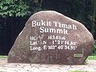
Clockwise: A busy intersection between Bukit Panjang Road and Bukit Panjang Ring Road, Senja-Cashew Community Club with HDB flats in the background, Zhenghua Community Club, Summit of Bukit Timah Hill | |
 Location of Bukit Panjang in Singapore | |
| Coordinates: 1°22′51.00″N 103°45′45.00″E / 1.3808333°N 103.7625000°E | |
| Country | |
| Region | West Region
|
| CDC | |
| Town Council |
|
| Constituencies | |
| Government | |
| • Mayor | North West CDC
|
| • Members of Parliament | Bukit Panjang SMC
Holland-Bukit Timah GRC
|
| Area | |
• Total | 8.99 km2 (3.47 sq mi) |
| • Residential | 2.19 km2 (0.85 sq mi) |
| Population | |
• Total | 138,050 |
| • Density | 15,000/km2 (40,000/sq mi) |
| Demonym |
|
| Ethnic groups | |
| • Chinese | 102,800 |
| • Malays | 21,690 |
| • Indians | 10,340 |
| • Others | 3,450 |
| Postal districts | 21, 23 |
| Dwelling units | 34,463 |
| Projected ultimate | 44,000 |
Bukit Panjang (IPA: /ˈbʊkɪt ˌpɑːndʒɑːŋ/ BUUK-it PAHN-jahng) is a planning area and residential town located in the West Region of Singapore. A portion of this town is situated on a low-lying elongated hill. The planning area is bounded by Bukit Batok to the west, Choa Chu Kang to the northwest, Sungei Kadut to the north, the Central Water Catchment to the east, and Bukit Timah to the south. Bukit Panjang New Town is located at the northern portion of the planning area. Bukit Panjang has an average elevation of 36m/118 ft.[4]
The town is categorised into seven subzones, namely Jelebu, Bangkit, Fajar, Saujana, Senja, Dairy Farm, and Nature Reserve.
- ^ a b "Bukit Panjang (Planning Area, Singapore) - Population Statistics, Charts, Map and Location". www.citypopulation.de. Retrieved 10 April 2018.
- ^ a b HDB Key Statistics FY 2014/2015 Archived 4 March 2016 at the Wayback Machine
- ^ a b "Statistics Singapore - Geographic Distribution - Latest Data". Retrieved 10 January 2024.
- ^ elevationmap.net. "Bukit Panjang New Town Singapore on the Elevation Map. Topographic Map of Bukit Panjang New Town Singapore". elevationmap.net. Retrieved 10 April 2018.


