Back Bundesautobahn 10 Afrikaans الطريق السريع 10 (ألمانيا) Arabic Dálnice A10 (Německo) Czech Bundesautobahn 10 Danish Bundesautobahn 10 German Germana aŭtovojo A10 Esperanto آزادراه ۱۰ (آلمان) Persian Bundesautobahn 10 Finnish Bundesautobahn 10 French כביש 10 (גרמניה) HE
| A 10 | ||||
|---|---|---|---|---|
| Bundesautobahn 10 | ||||
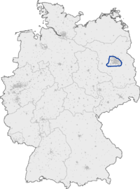
Map of Berlin (A 10 highlighted) | ||||
| Route information | ||||
| Length | 196 km (122 mi) | |||
| Major junctions | ||||
| Beltway around Berlin | ||||
| Location | ||||
| Country | Germany | |||
| States | Berlin, Brandenburg | |||
| Highway system | ||||
| ||||
| ||||
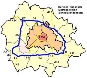
Bundesautobahn 10 (translates from German as Federal Motorway 10, short form Autobahn 10, abbreviated as BAB 10 or A 10) is an orbital motorway around the German capital city of Berlin. Colloquially called Berliner Ring (Berlin Beltway), it is predominantly located in the state of Brandenburg, with a short stretch of 5 km (3 miles) in Berlin itself. It should not be confused with the Berliner Stadtring (Bundesautobahn 100) around Berlin's inner city.
With a total length of 196 km (122 miles), the BAB 10 is the longest orbital in continental Europe (Route 1 in Iceland is 1,322 km (821 mi)). The BAB 10 is 8 km (5 miles) longer than the M25 motorway around London.


