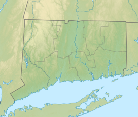
| Burr Pond State Park | |
|---|---|
 | |
| Location | Torrington, Connecticut, United States |
| Coordinates | 41°52′10″N 73°05′50″W / 41.86944°N 73.09722°W[1] |
| Area | 438 acres (177 ha)[2] |
| Elevation | 988 ft (301 m)[1] |
| Established | 1949 |
| Administered by | Connecticut Department of Energy and Environmental Protection |
| Designation | Connecticut state park |
| Website | Official website |
Burr Pond State Park is a public recreation area covering 438 acres (177 ha) adjacent to Paugnut State Forest in the town of Torrington, Connecticut. The state park surrounds Burr Pond, an 85-acre (34 ha),[3] man-made body of water with facilities for swimming, boating, and fishing. It is managed by the Connecticut Department of Energy and Environmental Protection.[4]
- ^ a b "Burr Pond". Geographic Names Information System. United States Geological Survey, United States Department of the Interior.
- ^ Cite error: The named reference
pristaffwas invoked but never defined (see the help page). - ^ Cite error: The named reference
bathymetrywas invoked but never defined (see the help page). - ^ Cite error: The named reference
DEEPwas invoked but never defined (see the help page).


