Back Isleta da Cal AN Ilhéu de Baixo CEB Ilhéu da Cal German Islote de Cal Spanish Ilhéu da Cal Finnish Îlot de Cal French Ilhéu da Cal Dutch Ilhéu da Cal Portuguese Кал (остров) Russian
 Cal Islet, viewed from Porto Santo | |
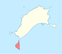
 Location within the Municipality of Porto Santo | |
| Geography | |
|---|---|
| Location | Atlantic Ocean |
| Coordinates | 33°00′32″N 16°23′13″W / 33.0089°N 16.3869°W |
| Total islands | 1 |
| Area | 1.40 km2 (0.54 sq mi) |
| Highest elevation | 178 m (584 ft) |
| Administration | |
| Autonomous Region | |
| Municipality | Porto Santo |
| Freguesia | Porto Santo |
| Demographics | |
| Population | 0 |
Cal Islet (Portuguese: Ilhéu da Cal, also: Ilhéu de Baixo) is a small island about 500 m (1,600 ft) south of Porto Santo Island, in the Madeira Archipelago, Portugal. With an area of 1.40 km2 (0.54 sq mi),[1] Cal is the largest of six islets close to Porto Santo. The highest point is 178 m (584 ft).[2] The islet has never been inhabited.
- ^ m@pas online Archived 2018-09-14 at the Wayback Machine, Direção-Geral do Território
- ^ Porto Santo – História