Back Kaap-tot-Kaïro-spoorlyn Afrikaans سكك حديد كيب القاهرة Arabic Ferrocarril de Ciudá del Cabu a El Cairo AST Kap-Kairo-Plan German Ferrocarril de Ciudad del Cabo a El Cairo Spanish Kap–Kairo-rautatiesuunnitelma Finnish Chemin de fer Le Cap – Le Caire French מסילת הרכבת קהיר-קייפטאון HE Jalur kereta api Cape Town-Kairo ID Ferrovia Città del Capo-Il Cairo Italian
| Cairo–Cape railway | |
|---|---|
| Overview | |
| Status | Only a few stretches in operation 5,625 kilometres (3,495 mi) |
| Termini |
|
| Service | |
| Type | Heavy rail |
| Technical | |
| Line length | 10,489 km (6,518 mi) |
| Track gauge | 1,435 mm (4 ft 8+1⁄2 in) standard gauge 1,067 mm (3 ft 6 in) Cape gauge |


This map shows the chain of colonies from the Cape to Cairo through which the railway would run. From 1916, Tanganyika Territory was added, filling in the gap.


The Cape to Cairo Railway is an unfinished project to create a railway line crossing from southern to northern Africa. It would have been the largest, and most important, railway of the continent. It was planned as a link between Cape Town in South Africa and Port Said in Egypt.[1][2]
The project was never completed. Completed parts have been inoperative for many years, as a result of wars and lack of maintenance by the former colonies.[citation needed]
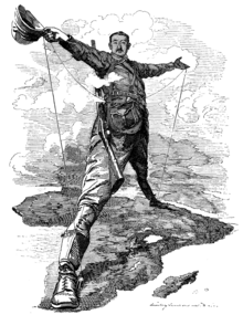
The plan was initiated at the end of the 19th century, during the time of Western European colonial rule. It was largely based on the vision of Cecil Rhodes, an attempt to connect African colonies of the British Empire through a continuous railway line from Cape Town, South Africa to Cairo, Egypt.[3]
- ^ Railways of Congo. Shandong: XH Company Minning. 2020.
- ^ Minning areas in Congo. SKY Company. 2020.
- ^ Pitt, Colin (2016). The story of the cape to Cairo Railway. Vol. 2. CP Press. ISBN 978-1910241240.