Back Central Milton Keynes CEB Central Milton Keynes French Central Milton Keynes Dutch Central Milton Keynes NB Central Milton Keynes Polish Central Milton Keynes Swedish Central Milton Keynes ZH-MIN-NAN
| Central Milton Keynes | |
|---|---|
| Civil parish and central business district | |
Location within Buckinghamshire | |
| Area | 0.9 sq mi (2.3 km2) |
| Population | 2,726 (2011 Census)[1] |
| • Density | 3,029/sq mi (1,170/km2) |
| OS grid reference | SP851389 |
| Civil parish |
|
| District | |
| Unitary authority | |
| Ceremonial county | |
| Region | |
| Country | England |
| Sovereign state | United Kingdom |
| Post town | MILTON KEYNES |
| Postcode district | MK9 |
| Dialling code | 01908 |
| Police | Thames Valley |
| Fire | Buckinghamshire |
| Ambulance | South Central |
| UK Parliament | |
| Website | cmktowncouncil |
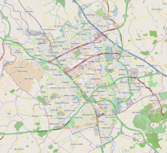
Central Milton Keynes is the central business district of Milton Keynes, Buckinghamshire, England and a civil parish in its own right, with a town council.
The district is approximately 3.5 km (2.2 mi) long by 1 km (0.6 mi) wide and occupies some of the highest land in the city.[2] It contains (behind the Central Library) the historic site of the moot hill for Secklow (or Sigelai) Hundred.[3] It is the site of the central retail, business, law enforcement and governmental districts, Milton Keynes Central railway station and around 2,000 residential dwellings.
- ^ UK Census (2011). "Local Area Report – Central Milton Keynes CP (E04012182)". Nomis. Office for National Statistics. Retrieved 1 October 2019.
- ^ Cite error: The named reference
OS-192was invoked but never defined (see the help page). - ^ Information board at the site, at 52°02′40″N 0°45′36″W / 52.04444°N 0.76011°W (SP8513239174)


