| Central Panay Mountain Range | |
|---|---|
 Mount Madja-as is the highest peak in both the Central Panay Mountain Range and Panay Island. | |
| Highest point | |
| Peak | Mount Madja-as |
| Dimensions | |
| Length | 170 km (110 mi) |
| Width | 34 km (21 mi) |
| Geography | |
| Country | Philippines |
| Region(s) | Antique, Capiz, Iloilo, Aklan. |
| Range coordinates | 10°45′46″N 122°8′22″E / 10.76278°N 122.13944°E |
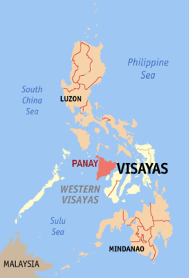
Central Panay Mountain Range is the longest and largest mountain range in the island of Panay and Western Visayas in the Philippines. With a total length of 170 km (110 mi) long north–south and 34 km (21 mi) width east–west. Mount Madja-as is the highest point with an elevation of 6,946 feet (2,117 metres) above sea level. It is famous for its diverse flora and fauna, mossy forest, pristine river's, Waterfalls and clusters of Rice Terraces. Located through the western Panay, from vicinity of Ibajay, Aklan to the north to Anini-y, Antique southern tip to the south. Occupied almost the entire province of the eastern portions of Antique, western Iloilo, western Capiz and western Aklan.

