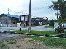
Changkat Kruing | |
|---|---|
 Changkat Kruing Street | |
| Coordinates: 4°23′N 100°41′E / 4.383°N 100.683°E | |
| Country | Malaysia |
| State | Perak |
| Established | 1900s |
| Elevation | 56 m (183.7 ft) |
| Time zone | UTC+8 (MST) |
| • Summer (DST) | Not observed |

Changkat Kruing is a small village in Manjung District, Perak, Malaysia.
The village is located between Ayer Tawar and Pantai Remis which is 20 km from Ayer Tawar and 14 km from Pantai Remis. Dinding River passes by the village. A planned spur of the West Coast Expressway to Changkat Keruing that would have connected the village to Siputeh was ultimately scrapped.[1]
- ^ "WCE's 2-decade journey near completion". The Malaysian Reserve. 2023-07-31. Retrieved 2025-02-02.

