Back Charlotte Amalie Afrikaans Ceorlette Amaliaburh ANG شارلوت أمالي Arabic شارلوت امالى ARZ Carlota Amalia AST Şarlotta-Amaliya Azerbaijani Шарлота-Амалія Byelorussian Шарлот Амалія BE-X-OLD Шарлот Амали Bulgarian Charlotte Amalie (Inizi Gwerc'h) Breton
Charlotte Amalie | |
|---|---|
|
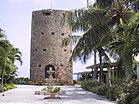
Top: Lookout View of Charlotte Amalie; Upper Middle: Rothschild Francis Market Square, Fort Christian; Middle: Villa Nottman, Blackbeard's Castle; Lower Middle: Legislature Building (Capitol Building), VI Alexander A Farrelly Justice Complex and Ron De Lugo US Federal Building on the far right. | |
Location within the United States Virgin Islands | |
| Coordinates: 18°21′N 64°57′W / 18.350°N 64.950°W | |
| Country | |
| Territory | |
| District | Saint Thomas-Saint John |
| Island | Saint Thomas |
| Subdistrict(s) | Charlotte Amalie, Northside |
| Government | |
| • Mayor | None[1] |
| Area | |
• Town | 3.14 km2 (1.213 sq mi) |
| • Urban | 8.7 km2 (3.36 sq mi) |
| Population (2020)[2] | |
• Town | 8,194 |
| • Density | 2,600/km2 (6,800/sq mi) |
| • Urban | 14,477 (subdistrict) |
| Time zone | UTC-04:00 (AST) |
| • Summer (DST) | (Not Observed) |
| ZIP code(s) | 00801, 00802, 00803, 00804 |
| Area code | 340 |
| Major routes | |
Charlotte Amalie (/ˈʃɑːrlət əˈmɑːli(ə)/ SHAR-lət ə-MAH-lee(-ə); Danish: [ʃɑˈlʌtʰə ɑˈmɑːljə]),[3] located in Saint Thomas, is the capital and largest town of the U. S. Virgin Islands. It is located on the island's southern shore at the head of Saint Thomas Harbor. The town is known for its historic sites, Danish colonial architecture, harbor, and shopping.[4][5] In 2020, it had a population of 8,194,[6] making it the most densely populated town in the U.S. Virgin Islands.
It has a deep-water harbor that was once a haven for pirates (including Blackbeard) and is now one of the busiest ports of call for cruise ships in the Caribbean.[4] About 1.5 million-plus cruise ship passengers land there annually, and hundreds of ferries and yachts pass by each week. Protected by Hassel Island, the harbor has docking and fueling facilities, machine shops, and shipyards and was a U.S. submarine base until 1966.
- ^ "Puerto Rico and the Outlying Areas" (PDF). Geographic Areas Reference Manual. Bureau of the Census. 1994. pp. 38–40. Retrieved May 9, 2023.
The only functioning governmental unit in the Virgin Islands is the territorial government.
- ^ "Table 1. Population of the United States Virgin Islands : 2010 and 2020" (PDF). United States Census Bureau. Retrieved November 25, 2024.
- ^ "How to Pronounce Charlotte Amalie (Real Life Examples!)". YouTube.
- ^ a b "St. Thomas". VI Department of Tourism. Retrieved February 9, 2025.
- ^ "Caribbean Journal - The Next Great Caribbean Waterfront Downtown Is in St Thomas". www.caribjournal.com. Retrieved February 9, 2025.
- ^ "Table 1. Population of the United States Virgin Islands : 2010 and 2020" (PDF). United States Census Bureau. Retrieved November 25, 2024.


