Back ضاحية تشيناي Arabic चेन्नई जिला Bihari চেন্নাই জেলা Bengali/Bangla Districte de Chennai Catalan Chennai (distrito) CEB Distrito de Chennai Spanish Chennai barrutia Basque بخش چنای Persian Chennain piirikunta Finnish District de Madras French
Chennai District
Madras | |
|---|---|
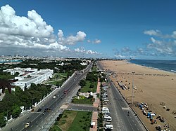
 View of Marina Beach | |
Nicknames:
| |
 Location in Tamil Nadu | |
| Coordinates: 13°5′2″N 80°16′12″E / 13.08389°N 80.27000°E | |
| Country | |
| State | |
| Region | Chola Nadu |
| Headquarters | Chennai |
| Talukas | Alandur, Aminjikarai, Ambattur, Ayanavaram, Egmore, Guindy, Kolathur, Madhavaram, Manali, Maduravoyal, Mylapore, Mambalam, Purasawalkam, Perambur, Shollinganallur, Thiruvottiyur, Tondiarpet, Velachery |
| Government | |
| • District Collector | Rashmi Siddharth Zagade, IAS |
| Area | |
• Total | 426 km2 (164 sq mi) |
| Elevation | 6.7 m (22.0 ft) |
| Population (2011)[4] | |
• Total | 6,748,026 |
| • Density | 16,000/km2 (41,000/sq mi) |
| Demonym(s) | Chennaiite Chennaikaran |
| Languages | |
| • Official | Tamil |
| Time zone | UTC+5:30 (IST) |
| PIN | 600XXX |
| Telephone code | 44 |
| ISO 3166 code | 044 |
| Vehicle registration | TN01 To TN14 TN18 TN22 TN85 |
| Per Capita Income (2022-23) | ₹585,501 (US$7,448.7) [5] |
| Sex ratio | 951 female / 1000 male[6] |
| Nominal GDP (2022-23) | ₹289,481.19 crore (US$36.83 billion) [7] |
| Website | https://chennai.nic.in/ |
Chennai district, formerly known as Madras district,[a] is one of the 38 districts in the state of Tamil Nadu, India. It is the smallest and the most densely populated district in the state. The district is coterminous with the city of Chennai, which is administered by the Greater Chennai Corporation. It is surrounded by Tiruvallur district in the north and the west, Kanchipuram district in the south-west, Chenglpattu district in the south, and the Bay of Bengal in the east.
As of 2011, the district had a population of 67,48,026 with a sex-ratio of 989 females for every 1,000 males.[6] Much of the district's population descended from its settlements in the 1st century CE to the Middle Ages, but the diversity has grown much since then. The district consists of only one civic body, the megacity of Chennai, which forms the core and the most notable portion of the much bigger Chennai metropolis, or officially, the Chennai Metropolitan Area. In 2018, the district's limits were expanded, aligning with that of the newly expanded Greater Chennai Corporation, which had annexed adjacent municipalities. It resulted in the area being increased from 175 square kilometres (68 sq mi) to 426 square kilometres (164 sq mi).[3][8] The district is divided into three revenue divisions and ten taluks.
- ^ "Chennai has emerged as India's Detroit". Deccan Herald. Retrieved 7 June 2017.
- ^ "India Is Becoming A Hub For 'Medical Tourists' — Despite The 'Million Dollar Difference' In Care". Business Insider. 12 June 2014. Retrieved 21 March 2017.
- ^ a b Cite error: The named reference
TH-5Janwas invoked but never defined (see the help page). - ^ Cite error: The named reference
distwebsitewas invoked but never defined (see the help page). - ^ "District Income estimates".
- ^ a b Cite error: The named reference
dchb-bwas invoked but never defined (see the help page). - ^ "District Income estimates".
- ^ Yogesh, Kabirdoss (19 January 2018). "Chennai district boundaries likely to be redrawn on April 1". The Times of India. Retrieved 23 November 2019.
Cite error: There are <ref group=lower-alpha> tags or {{efn}} templates on this page, but the references will not show without a {{reflist|group=lower-alpha}} template or {{notelist}} template (see the help page).