Back Chippendale CEB چیپندیل، نیو ساوت ولز Persian Chippendale (Sydney) French צ'יפנדייל (ניו סאות' ויילס) HE Chippendale, New South Wales Malay Chippendale (Sydney) Polish Chippendale, New South Wales Romanian Chippendale, New South Wales Swedish چپنڈیل، نیو ساؤتھ ویلز Urdu 奇彭代爾 (新南威爾士州) Chinese
| Chippendale Sydney, New South Wales | |||||||||||||||
|---|---|---|---|---|---|---|---|---|---|---|---|---|---|---|---|
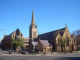
 St Benedicts Church and University of Notre Dame | |||||||||||||||
 | |||||||||||||||
| Population | 7,803 (SAL 2021)[1] | ||||||||||||||
| Postcode(s) | 2008 | ||||||||||||||
| Area | 0.7 km2 (0.3 sq mi) | ||||||||||||||
| Location | 2 km (1 mi) south of CBD | ||||||||||||||
| LGA(s) | City of Sydney | ||||||||||||||
| State electorate(s) | Newtown | ||||||||||||||
| Federal division(s) | Sydney | ||||||||||||||
| |||||||||||||||
33°53′11″S 151°12′00″E / 33.8863°S 151.1999°E Chippendale is a small inner-city suburb of Sydney, New South Wales, Australia on the southern edge of the Sydney central business district, in the local government area of the City of Sydney. Chippendale is located between Broadway to the north and Cleveland Street to the south, Central railway station to the east and the University of Sydney to the west.
- ^ Australian Bureau of Statistics (28 June 2022). "Chippendale (suburb and locality)". Australian Census 2021 QuickStats. Retrieved 28 June 2022.