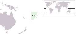
 Map of Vanua Levu | |
 | |
| Geography | |
|---|---|
| Location | Pacific Ocean |
| Coordinates | 17°17′S 178°47′W / 17.283°S 178.783°W |
| Archipelago | Vanua Levu Group |
| Administration | |
Fiji | |
| Division | Northern Division |
| Demographics | |
| Population | 100 (2017) |
17°16′53″S 178°47′11″W / 17.28139°S 178.78639°WCikobia-i-Lau,[note 1] or Cirikalia, is an island in the Lau Islands in the north-east of Fiji. The island has historically been called Thikombia,[1] Thimkombia-i-Lau[2] or Farewell Island.[1]
Cite error: There are <ref group=note> tags on this page, but the references will not show without a {{reflist|group=note}} template (see the help page).
- ^ a b Nunn, Patrick D. (1990). "Coastal Processes and Landforms of Fiji: Their Bearing on Holocene Sea-Level Changes in the South and West Pacific". Journal of Coastal Research. 6 (2): 279–310. ISSN 0749-0208. JSTOR 4297680.
- ^ Nunn, Patrick D. (August 1987). "Late Cenozoic tectonic history of Lau Ridge, Southwest Pacific, and associated shoreline displacements: Review and analysis". New Zealand Journal of Geology and Geophysics. 30 (3): 241–260. doi:10.1080/00288306.1987.10552620. ISSN 0028-8306.
