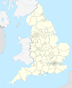
Back سیتی لیدز AZB Лийдс (община) Bulgarian City and Borough of Leeds CEB Dinas Leeds Welsh City of Leeds German سیتی لیدز Persian Cité de Leeds French Kota Leeds ID Città di Leeds Italian シティ・オブ・リーズ Japanese
Leeds,[7] also known as the City of Leeds, is a metropolitan borough with city status in West Yorkshire, England. The metropolitan borough includes the administrative centre of Leeds and the towns of Farsley, Garforth, Guiseley, Horsforth, Morley, Otley, Pudsey, Rothwell, Wetherby and Yeadon.[8] It has a population of 822,483 (2022), making it technically the second largest city in England by population behind Birmingham, since London is not a single local government entity. Local governance sits with Leeds City Council and the city's 32 Parish Councils.
The current city boundaries were set on 1 April 1974 by the provisions of the Local Government Act 1972, as part a reform of local government in England. The city is a merger of eleven former local government districts; the unitary City and County Borough of Leeds combined with the municipal boroughs of Morley and Pudsey, the urban districts of Aireborough, Garforth, Horsforth, Otley and Rothwell, and parts of the rural districts of Tadcaster, Wharfedale and Wetherby from the West Riding of Yorkshire.
For its first 12 years the city had a two-tier system of local government; Leeds City Council shared power with West Yorkshire County Council. Since the Local Government Act 1985 Leeds City Council has effectively been a unitary authority, serving as the sole (aside from the 32 Parish Councils) executive, deliberative and legislative body responsible for local policy, setting council tax, and allocating budget in the city, and is a member of the Leeds City Region Partnership.
Although the city's area includes 32 civil parishes, most of Leeds' population currently live in unparished areas. In these areas the Localism Act 2011 makes provision for groups of people from the community, called neighbourhood forums, to formulate Neighbourhood Development Plans and Orders intended to guide and shape development in their own locality.[9]
- ^ a b "Leeds, Yorkshire and the Humber". Ordnance Survey. Retrieved 28 January 2024.
- ^ "Your council". Leeds City Council. Retrieved 28 January 2024.
- ^ "Mid-Year Population Estimates, UK, June 2022". Office for National Statistics. 26 March 2024. Retrieved 3 May 2024.
- ^ "Mid-Year Population Estimates, UK, June 2022". Office for National Statistics. 26 March 2024. Retrieved 3 May 2024.
- ^ a b UK Census (2021). "2021 Census Area Profile – Leeds Local Authority (E08000035)". Nomis. Office for National Statistics. Retrieved 28 January 2024.
- ^ a b Fenton, Trevor (25 April 2023). "Regional gross domestic product: city regions". Office for National Statistics. Retrieved 2 September 2023.
- ^ "Local Authority Districts, Counties and Unitary Authorities (April 2021) Map in United Kingdom". Office for National Statistics: Open Geography Portal. Retrieved 1 August 2023.
- ^ Van den Berg 2006, p. 179.
- ^ House of Commons, Neighbourhood planning, published 12 October 2018, accessed 21 March 2023


